For the record, I'm neither an academic nor a scholar, and admittedly, I've never been to many of the places posted here. So if someone should find a mistake, or believe I omitted something, please feel free to email me and I'll correct it.

I can be contacted at dms2_@hotmail.com.

Sunday, April 26, 2020

TEL AVIV

Tel Aviv built on ruins of Sheikh Munis, courtesy, Zochrot
Tel Aviv is the second largest city in Israel after Jerusalem with a population (not counting the metropolitan area) of approximately 450,000. The city is an anomaly in Israel. It can more properly be called “Occupied Palestinian Territory”, having been built on stolen land. According to the Palestinian narrative, the Jews in Palestine committed many atrocities against the Palestinian people in 1948 in order to expel them and thus, create the Jewish State of Israel. Even though this narrative is as false as you can get, unfortunately as far as Tel Aviv is concerned, it is actually true.

The genesis of Tel Aviv goes back to 1909. In that year, a group of Zionist extremists in Jaffa got together and decided to build a new town in order to escape the high rents in the city. So they move to some empty land to the north, land that was actually owned by the Palestinian village of Sheikh Munis, and the settlement of Tel Aviv was founded. Since then and until Israeli independence in 1948, Tel Aviv grew into a full-fledged city, threatening Sheikh Munis as well as the surrounding Palestinian villages and by 1948, the same Zionist extremists the founded the city, as well as their descendants, embarked on a campaign of rape, plunder, destruction, and expulsion. Sheikh Munis was totally obliterated save for a single building which today, lies on the campus of Tel Aviv University.

The story of Tel Aviv belies one fact about the Israelis and the other indigenous peoples in the Middle East and North Africa. Not a single nation in MENA, and indeed the rest of the world, is innocent and comes out of history with clean hands, including, unfortunately, the Jewish nation. Such a nation just simply doesn’t exist. But the best we can hope for is that nations should learn from their past mistakes and perhaps rectify them as much as is possible. In that vein, it is hoped that Israel will do the right thing. Though Jews are indeed indigenous to the Land of Israel – Judea, Samaria, Galilee, the Negev, and Gaza District (the Jewish villages of which, were illegally obliterated by the Zionists) – Tel Aviv is not a part of Israel and has no business being part of Israel. It should be returned to the Palestinian people and the local Jews should be evacuated and returned to Israel proper.

Monday, April 13, 2020

LAND OF GOSHEN

File:Land of Goshen - panoramio (1).jpg
Land of Goshen in Egypt, courtesy, commons.wikimedia.org
The Land of Goshen in Egypt stretches from the east Nile Delta in the north, to the northeast of Cairo in the south, and then stretching east covering roughly the entire northeastern corner of Egypt proper. This area had long been farmed by the ancient Egyptians since the Exodus, and later, their descendants, the Copts. However, since the 7th century, it was taken over by Arabs. Today, few Copts dwell there in a sea of hostile Arab settlers. The closest location for a major Coptic community is now found in Cairo as well as in several locations in other parts of the Delta.
Goshen is named in the Bible as the place in Egypt given by Pharaoh to the Hebrews who had joined their brother Joseph who was vizier over Egypt at the time (Book of GenesisGenesis 45:9-10), and the land from which they later left at the time of the Exodus. After the death of Joseph and those of his generation, the following generations of Israelites had become populous in number. The Egyptians feared potential integration or takeover, so they enslaved the Israelites and took away their human rights. Four hundred and thirty years later, to the day, Moses led the Israelites out of Egypt, encamping at Succoth, the first waypoint of the Exodus.
Goshen is the home to the ancient sites of Pithom, Raamses, and On (Heliopolis), major cities in ancient Egypt. Regarding Pithom, multiple references in ancient GreekRoman, and Hebrew Bible sources exist for this city, but its exact location remains somewhat uncertain. A number of scholars identified it as the later archaeological site of Tell El Maskhuta. Others identified it as the earlier archeological site of Tell El Retabeh. In the Greco-Roman period, the city was called Heroöpolis. Since it was located nearly due north of the Bitter Lakes, Heroöpolis was of sufficient importance, as a trading station. It was the capital of the 8th nome of Lower Egypt.
In the spring of 1883, archaeologist Edouard Naville believed he had identified Pithom as the archaeological site Tell El Maskhuta. The site of Pithom, as identified by Naville, is at the eastern edge of Wadi Tumilat, south-west of Ismaïlia. Petrie agreed with this identification. John Holladay, a more recent investigator of the site, also supports this opinion.
More recent analyses have demonstrated that the designation for the temple of Atumpr-itm, can be found in inscriptions at both sites—both at Tell El Retaba and at Tell El Maskhuta. This seems to demonstrate that the name 'Pithom' was used originally for the earlier site, Tell El Retaba, before it was abandoned. And when the newer city of Tel El Maskhuta was built, the same name was applied to it as well – as the temple of Atum was moved to El Maskhuta. Thus, in effect, 'Pithom' was moved to a new location, which phenomenon is attested with some other cities as well, such as Migdol.
Pi-Ramesses was the new capital built by the Nineteenth Dynasty Pharaoh Ramesses II (1279–1213 BC) at Qantir, near the old site of Avaris. The city had served as a summer palace under Seti I (c. 1290–1279 BC), and may have been founded by Ramesses I (c. 1292–1290 BC) while he served under Horemheb.
In 1884, Flinders Petrie arrived in Egypt to begin his excavations there. His first dig was at Tanis, where he arrived with 170 workmen. Later in the 1930s, the ruins at Tanis were explored by Pierre Montet.
The masses of broken Ramesside stonework at Tanis led archaeologists to identify it as Pi-Ramesses. Yet it eventually came to be recognized that none of these monuments and inscriptions originated at the site.
In the 1960s, Manfred Bietak, recognised that Pi-Ramesses was known to have been located on the then easternmost branch of the Nile. He painstakingly mapped all the branches of the ancient Delta and established that the Pelusiac branch was the easternmost during Ramesses' reign while the Tanitic branch (i.e. the branch on which Tanis was located) did not exist at all. Excavations were therefore begun at the site of the highest Ramesside pottery location, Tell el-Dab'a and Qantir.
Although there were no traces of any previous habitation visible on the surface, discoveries soon identified Tell el-Dab'a as the Hyksos capital Avaris. Qantir was recognized as the site of the Ramesside capital Pi-Ramesses.[3]
Heliopolis, orginially the town of On, was a major city of ancient Egypt. It was the capital of the 13th or Heliopolite Nome of Lower Egypt and a major religious center. It is now located in Ayn Shams, a northeastern suburb of Cairo.
The major surviving remnant of Heliopolis is the obelisk of the Temple of Ra-Atum erected by Senusret I of Dynasty XII. It still stands in its original position, now within Al-Masalla in Al-MatariyyahCairo.
Today, there are many cities and towns in the area that have kept their indigenous Coptic names, but are popularly referred to by the names given to them by Arab settlers. Mit Ghamr, for example, has a large Coptic Orthodox Church, the Marigirgis Church. It is said that during the great fire in 1920 which destroyed much of the town, the church was saved when the spirit of Saint George appeared atop this church on his horse. Other locations include: Onufe (Menouf), Tantato (Tanta), Zewete (Zefta), Limne Nikedjow (Lake Burullus), Dishairi (El Mahalla El Kubra), Damiadi (Damietta), Bisewun (Basyoun), Banaho (Benha), Jokejik (Zagazig), Tanis (Shentana el Haggar).

GATH

site of ancient Gath, courtesy, Wikipedia
Archeologists have identified the ancient site of Gath with Tel es Safi in the Shephelah region south of Tel Aviv. However, that theory was challenged in the 50s by archaeologist William F. Albright. He suggested another site, Tell 'Areini which, despite some opposition, was accepted to the point that the Israel Government Names Committee renamed it as Tel Gat in 1953. However, excavations at Tell 'Areini starting in 1959 found no Middle Bronze Age traces and the excavators proposed instead that Gath be identified with a third site, Tell en-Nejileh (Tel Nagila), a proposal abandoned after excavations in the 1980s. Attention then returned again to Tell es-Safi, which is thought to be the location of Gath. Extensive exploration of the site was not conducted until 1996, when a long-term project was commenced there, directed by Aren Maeir of Bar-Ilan University.

According to the Books of Joshua and I Samuel, Gath was one of the five principal cities of the Philistines which was later allotted to the tribe of Judah. But at the time of Joshua, the Israelites did not conquer it. Gath was the native city of Goliath (I Sam. xvii.). After David’s victory over him and the other Philistines, he took refuge with the Philistine King Achish of Gath (I Sam, xxi. 10, xxvii. 2). According to II Chron. xi. 8, Rehoboam fortified the city, which, however, must have fallen into the hands of the Philistines again, and later to the Syrians under Hazael, but afterwards it was conquered by Uzziah of Judah thus falling back into Israelite hands (II Chron. xxvi. 6). According to an Assyrian inscription, during the reign of King Ahab over Judah, King Sargon of Assyria conquered Gath along with other Philistine cities (comp. Amos vi. 2; Micah i. 14).
In modern times, the city of Kiryat Gat, named after the ancient site, was founded in 1954, initially as a ma'abara. The following year it was established as a development town by 18 families from Morocco. The population rose from 4,400 inhabitants in 1958 to 17,000 in 1969, mostly from Jewish immigrants from North Africa. The economy was initially based on processing the agricultural produce of the Lachish region, such as cotton and wool. In December 1972, Kiryat Gat's municipal status was upgraded and it became Israel's 31st city.
During the 1990s, the mass immigration of Soviet Jews to Israel brought many new residents to the town and its population grew to 42,500 by 1995. The development of the Rabin industrial zone on the eastern edge of the city, and the opening of Highway 6 further improved the local economy.

GILGAL


site of ancient Gilgal, courtesy, BibleWalks.com
Gilgal was the first camping-place of the Israelites in the land west of the Jordan; the place to which they could retreat during their struggles for conquest. It was also the main military camp for Joshua and his fighting men during the initial phases of the conquest. According to Joshua 5:9, the place was called “Gilgal” because it was here that the lord said to Joshua, “I have rolled away (Heb. “Gilgal”) the reproach of Egypt from off you…” After the allotment of land to the tribes of Israel, Gilgal became part of Menasheh territory, almost adjacent to the border of Benjamin and right next door to Jericho which was part of Benjamin. The Ephraimite sanctuary, so severely condemned by the Prophets, was probably to be identified with the "Gilgal" of the Joshua narrative. It was also mentioned as a place of sacrifice in I Sam. 10:8. Its name could still be found on the hill Jaljul, east of Jericho but some scholars believe that it is to be identified with Khirbet al Mafjir on the eastern border of Jericho.

Modern Gilgal was 
established in 1970 as a Nahal settlement and was converted to a civilian kibbutz in 1973. Gilgal has invested millions of dollars in state-of-the-art water technology to boost its production of medjool dates. The system is based on the utilization of wastewater.


GILEAD

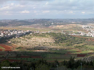
site of Tishbi in Gilead, home of the Prophet Elijah, courtesy, BiblePlaces.com
Gilead was an ancient region lying on the east side of the Jordan in what is today, the Arab-occupied Hashemite Kingdom of Jordan. It was also the site of a town of the same name where a treaty was proclaimed between Jacob who, with his family, had fled from the house of Laban his father-in-law in Aram Dimashq, and Laban himself. After the Exodus and Joshua’s conquests, the region of Gilead was allotted mostly to the tribe of Gad with the remainder going to the half-tribe of Menasheh. The town of Ramot Gil’ad, according to Joshua 20:8, became one of the Levitical cities as well as a city of refuge. Yavesh Gil’ad was the principal city and first mentioned in connection with the war between the Benjaminites and the other tribes of Israel. Because the local Gadites had refused to march against the Benjaminites, 12,000 Israelites were sent against them. All the people of the city were slain except 400 virgins who were spared only to be given as wives to the surviving Benjaminites. In the beginning of the reign of Saul, the city was attacked by Nahash, King of Ammon, and was forced to apply to Saul for help. The inhabitants of Yavesh Gil’ad remained grateful to Saul for his assistance, and when he and his three sons were killed by the Philistines on Mount Gilboa, they went by night, took the bodies from the wall of Beth She’an, brought them to Yavesh, burned them, buried the remains, and fasted seven days. For this deed, Yavesh Gil’ad was afterward highly lauded. Much later, during the period of the divided Kingdom, there preached the Prophet Elijah, a native of the town of Tishbi located in Gilead.


During the Islamic period, the territories on the east side of the Jordan, being so close to the Arabian Desert, were one of the first of the ancient Israelite territories to be settled by Arab tribes, and throughout the centuries, both Arab and Jewish Bedouin would traverse the area.

Ajlun (the Arabic name for Gilead) was an important Jewish center in the Middle Ages. In the 12th century, the Spanish Jewish traveler and explorer Benjamin of Tudela wrote of a Jewish community in Ajlun with a population of 60 families lead by three sheikhs – Zadok, Yitzhak, and Shlomo. For a period of time, the rabbis of Jerusalem debated whether certain parts of the territories east of the Jordan, including Ajlun, were part of the Land of Israel according to halacha, and therefore subject to the laws that can only be observed in Israel. People often expressed their opinions, but one opinion that carried much weight was that of the Palestinian geographer Ashturi HaParhi who considered the town as part of Israel. The matter was finally settled at the end of the 16th century when Ajlun, along with other towns in the area, were officially considered a part of Israel according to halacha. (NOTE: At that time, whether a rabbinic authority was pro or con, no one even discussed the possibility of uprooting Jews from there. And the Jews from there never said that they were there in order to protect Jaffa.)

In 1879, the region was proposed as a place of Jewish settlement by the English adventurer Laurence Oliphant. By that time, Ajlun had long been abandoned but there was still an intermittent Jewish presence in the region among the local Bedouin. Many Jews would come to Jerash, for example, for trade making that town, a major commercial center, a status it retained until the 1920s.

In the 1890s, one of the earliest halutzim, Isaiah Rafalovich, lived for a while in es Salt. During World War I, the Battle of es Salt, one of many battles that were fought in the Gilead region, and fought between the Turks and the Jewish Legion, was among the most decisive battles in the War that allowed the British to take control of Palestine. When the British authorities created Transjordan in 1922, the territories east of the Jordan, including Gilead, became off limits to Jews. Today, in spite of the peace treaty with Jordan, the ban on Jewish residency in the area is still in force.

MOUNT GILBOA

Mount Gilboa, courtesy, Wikipedia
Mount Gilboa was the ancient name given to the bow-shaped mountain chain situated north of the Samarian Mountains, and separating the plain of Jezreel from the valley of the Jordan. It also slopes off abruptly toward the vicinity of Ein Harod in the northwest.
Mt. Gilboa was the scene in which Saul and his sons were killed in battle with the Philistines (i Sam. 31:1–6). David cursed the mountain in his lament over Saul and his sons (ii Sam. 1:21): "Ye mountains of Gilboa, let there be no dew nor rain upon you, neither fields of choice fruits."
In September 1921, kibbutz Ein Harod was established at the foot of the mountain, next to the Ein-Harod spring. It was later transferred to the northern side of the Harod Valley. In the time of the British Mandate, especially between 1936 and 1939, Gilboa served as a base for Arab raids on the Jewish settlements in the Harod and Beth-Shean Valleys. Similarly, the Arab Legion and irregulars fortified positions on Mt. Gilboa during the War of Independence in the spring of 1948, with the aim of cutting off the Harod and Beth-Shean Valley settlements from the west. This danger was overcome with the occupation of the villages of Zarʿīn and Mazār by a Palmaḥ detachment. The 1949 armistice border, following the military front, gave Israel a foothold on the eastern rim of the mountain as well as the northern (where the moshav Gid’onah, originally named “Gilboa” was established) and left to Jordan most of its inhabited parts in the west and south.
Apart from the other new villages that were subsequently founded in the 1950s and 1960s at the foot of Mt. Gilboa in the west, north, and east, five settlements came into being on the mountain proper most notably – Nurit, established in 1950 as a moshav and later transformed into a Gadna training camp and nature study center, and Ma'aleh Gilboa, founded in 1962 as a Naḥal outpost, which became a civilian kibbutz affiliated with the Ha-Kibbutz ha-Dati movement in 1967. With the liberation of the rest of the Gilboa mountain chain in the course of the Six Day War in 1967, these communities entered into a period of prosperity. In 1982, Kibbutz Meirav, also affiliated with Ha-Kibbutz ha-Dati, was founded, as was Gan Ner in 1985.
Malkishua is a drug rehabilitation village founded in 1990 on the site of Kibbutz Meirav which had moved to its present location about one mile to the north on Mount Avinadav, part of the Gilboa chain, in 1987. The center was established by the National Authority for the War on Drugs and the regional council and was named after Malkishua, the son of King Saul, who fell on this spot while battling the Philistines (1 Samuel 31:2). In 1995 a youth treatment facility was added, and in 2002, Kedem, a center for religious youth, was founded. The center is today run by "Amutat Neve Malkishua" under the authority of the Ministry of Welfare & Social Services.
In addition, the Jewish National Fund had planted a forest on Mt. Gilboa with over 3,000,000 trees – one of the country's largest – and built many access roads and paths opening the mountain for tourism. A large area has been declared a nature reserve where plant species exclusive to Mt. Gilboa are afforded protection.

GIHON SPRING

The Gihon Spring Jerusalem's City of David. (Tal Glick/City of David Facebook)
Gihon Spring, courtesy, TimesOfIsrael.com
The ancient Gihon Spring is located between the Old City of Jerusalem and the City of David on the west, and the Kidron Valley and Mount of Olives on the east. Today, it is an archaeological site known as Kikar Gihon, Gihon Square, located along Derech HaShiloah. It is said that this spring rivals all the other springs in the Judean Hills with enough water flow that could fill 50,000 bottles per hour. According to the Talmud, Gihon is exactly in the center of the Land of Israel and owing to its peculiar ebb and flow, it has always been popularly regarded as an arm of the Mediterranean Sea.

King Solomon was anointed king at this spring. During the reign of King Hezekiah, a tunnel was built from the Gihon leading to the nearby Pool of Shiloah, approximately half a mile south. The opening of Gihon, which was not larger than a coin, was enlarged thus allowing water to flow more freely. But the work had scarcely been done when the stream grew less in volume. He therefore had it made smaller, whereupon the original quantity again appeared. The tunnel also provided the Temple with a fresh water supply. It was destroyed with the Roman destruction of Jerusalem. The tunnel, today, is dry. A little water is still found at the Gihon Spring but most of the local water is now found at the Pool of Shiloah.

GIBEON (GIV'ON)

the supposed site of ancient Gibeon, courtesy, BiblePlaces.com
Gibeon, or Giv’on, located to the north of Jerusalem, was one of the four cities of the Hivites, as is mentioned in the Biblical text. It later became a city in the Israelite territory of Benjamin. Today, all that remains of this Biblical city are a cluster of ancient ruins atop a tel. At present, the site is bordered, westward, by the Arab settlement of al-Jib and by the Jewish community of Giv’on HeHadasha (New Giv’on).


After the destruction of Jericho and Ai, the people of Gibeon sent ambassadors to trick Joshua and the Israelites into making a treaty with them. The Gibeonites presented themselves as ambassadors from a distant, powerful land. Without consulting the high priests, Israel entered into a mutual pact with them but Joshua then realized he had been deceived. In response, he cursed and enslaved them as woodcutters and water-carriers (Joshua 9:3-27). That it was not wholly in the possession of the Israelites, even during the time of King David and after, is shown by II Sam. Ch. 21. After the end of the Babylonian Captivity and the return of the Jews, Gibeon came within the borders of Judea. Josephus described the site as forty furlongs distant from Jerusalem, but in the course of the Roman occupation, Gibeon lay abandoned.

GivonHahadsha9824.JPG
the Israeli village of Giv'on Hadasha,
courtesy Wikipedia
In 1895, Jews began to return to the area, led by Yemenite Jews, and they established the village Giv’on HeHadasha nearby the ancient city’s ruins. They, later, left the area but it was again resettled in 1924. This new community was expelled by Arabs as a result of the Arab riots of 1929. It was resettled for a final time in 1977 by members of the organization Gush Emunim. It eventually absorbed many Jewish emigrants from the former Soviet Union, as well as many Sabras.

Today, Giv’on Hadasha continues to grow and develop, and presently includes the neighborhoods of Nahlat Banim, Dromit, Hazayit, Giv’on Mizrah, and Ginv’on Maarav. The town contains three gardens – Rosh HaGiv’a, Zima, and Pini – the synagogues Chayei Adam and Yisa Bracha, the Alon Community Club, a toy store, and a tool store.

Friday, April 3, 2020

GEZER

tel of ancient Gezer with kibbutz in right background, courtesy, BiblePlaces.com
The ancient town of Gezer today is a kibbutz in central Israel. Located in the Shephelah region between Modi'inRamle and Rehovot, it falls under the jurisdiction of the Gezer Regional Council. In 2018 it had a population of 286.
Gezer, originally a Canaanite town, was conquered by Joshua, but the Canaanite inhabitants were spared. It was designated a Levitical city, allotted to the tribe of Ephraim and located at the very edge of the tribal territory. At the beginning of the 10th century BCE, possibly during the reign of King Solomon, Gezer was conquered by the Egyptians but then the Pharaoh gave it to Solomon as a present (I Kings ix. 15-17). In the 4th century BCE, the town, along with the rest of the country, fell under Hellenist rule under Alexander the Great. It was later populated by Greek immigrants who settled there alongside the indigenous Jewish inhabitants. At the time of the Maccabees, Gezer, still under Hellenist rule, became a fortified city under Bacchides, a Hellenist general, but was conquered by Simon the Maccabee, who drove out the Greek settlers and their Jewish collaborators and settled it with faithful Jews according to the Book of Maccabees iv. 15; vii. 45; ix. 52; xiii. 43, 53; xiv. 7, 34; xv. 28; xvi. 1. Under the Roman general Gabinius, “Gazara” became the chief town of its district.
Gezer remained inhabited by Jews even after the Roman destruction of Jerusalem but abandoned a few centuries afterwards. The town eventually became a heap of ruins in which state in remained for many centuries. By the beginning of the 19th century, the Arab settlement of Abu Shusha had long been established adjacent to the site. In 1869, some of the village lands near the ruined site of Gezer (as yet, not identified as such until 1873) and adjacent to Abu Shusha were purchased by Melville Peter Bergheim, a banker from Germany who had settled in Israel many years previously and had later established a bank. According to rumor, he was born Jewish but had converted to Protestant Christianity as an adult before settling in Israel. Bergheim established a modern agricultural farm on his newly-purchased land using contemporary European methods and equipment. His ownership of the land was hotly contested by the villagers, by legal and illegal means, including the murder of his son Peter. After the Bergheim Bank became insolvent in 1892, his land, through an agreed-upon court arrangement, was managed jointly with a government receiver, Serapion Pasha, a resident of Jaffa. But legal disputes still plagued the area and in 1913, part of the land was sold by Serapion to the villagers and the rest to the Jewish Colonization Association, financially backed by the Baron de Rothschild. Disputes were finally settled when the JCA and Rothschild gave the Arab villagers one third of their purchase on a temporary lease basis until more reasonable accommodations were found. Aside from the legal disputes, Gezer/Abu Shusha was also plagued by constant attacks by roving Bedouin as well as from poor living conditions. In 1922, the land was sold to the Maccabean Land Company, a British Jewish company under Norman Bentwich, barrister. In 1945, the kibbutz was established. The earliest pioneers who settled there were immigrants from Europe, who named the kibbutz after the biblical city, Gezer, near which was the tel of the ancient town.
On June 10, 1948 during the War of Independence, the day after the Yiftah and Harel brigades attempted to take the site of Latrun, an Arab Legion battalion, supported by irregulars and a dozen armored cars, attacked the kibbutz which was defended by only 68 Haganah soldiers. After four hours of battle, the kibbutz fell. 39 defenders and 2 Arab Legionnaires were killed, a dozen kibbutzniks escaped and those who remained, were taken prisoner. It was then occupied by the Arabs but was later taken back by two Palmach squads. Because of its strategic location, it then served as a vantage point in Operation Dani (July 1948), which resulted in the inclusion of the towns of Ramleh and Lydda (Lod) in the State of Israel. After the war it was rebuilt, but came apart in 1964 due to social difficulties. The current kibbutz was founded on 4 July 1974, by a Gar'in group from North America.
The kibbutz has developed since and in the ensuing years, it would run various enterprises including a factory for adhesives and a special educational park, Ginat Shorashim, dedicated to peace and the environment and rooted in Jewish sources. A pumping station of the Yarkon-Negev water pipeline is located nearby. In 1983, Kibbutz Gezer Field, one of the few regulation baseball fields in Israel, was established, funded by American donors as well as by the Jewish National Fund. The first game was played within a few months. A backstop, covered benches for players and a refreshment stand were added at a later date. In 1989, a scoreboard and outfield fence were erected for the Maccabiah Games. In addition, the Gezer Pool, temporarily closed as of this writing, was a very popular local recreation site and is located near the Nahal Azaria.
Since 2014, a red-hair event has been held at the Kibbutz for the local Israeli red hair community. However, the number of attendees has to be restricted due to the risk of rocket attacks (which the Zionist government in Israel refuses to stop), leading to anger in the red-hair community.