For the record, I'm neither an academic nor a scholar, and admittedly, I've never been to many of the places posted here. So if someone should find a mistake, or believe I omitted something, please feel free to email me and I'll correct it.

I can be contacted at dms2_@hotmail.com.

Sunday, May 2, 2021

ROSH PINA

a view of Old Rosh Pina, courtesy, Wikpedia (Hebrew)

Rosh Pina is an Israeli town and local council in the Korazim Plateau in the Upper Galilee. It is situated on the eastern slopes of Mount Kna'an in the Northern District, roughly 5 miles north of the Sea of Galilee near the city of Safed. In 2019 it had a population of 3,148.

In Biblical times, the site of Rosh Pina was allotted to the Israelite tribe of Naphtali. Centuries later, during the Greek or Roman periods, a synagogue was built for the local inhabitants but it, as well as the rest of the town, was later abandoned, probably during the Byzantine period. Some time after the invasion of the Arabian caliph in the 7th century, various Arab tribes arrived in the area and settled there. The site of Rosh Pina was then established as the Arab village of al-Jauna. Beginning in 1878, Jews began to return to the area. In 1878, al-Jauna sold half its lands, about 2,500 dunum, to a group of native-born Jews from Safed led by Elazar Rokah. Settling in the newly-purchased lands, they called their settlement Gei Oni ("Valley of my Strength") as a Hebrew adaptation of the Arabic name. They fostered friendly relations with their Arab neighbors and often allied with them when fighting off Bedouin raids. After one year of good harvests, a year of drought saw the Arabs mortgage their lands to money lenders, but the Jews were unwilling to do the same and left. In 1882, the settlement was renewed as a moshavah by immigrants from Romania, who named it Rosh Pina ("cornerstone") after Psalm 118:22: "The stone which the builders rejected has become the cornerstone". A House of Dignitaries was built as a center of administration and finance for Rosh Pina as well as for other towns in the Galilee region. From this building, a loudspeaker was used to broadcast the local news. In 1883, the town became the first to come under the patronage of the Baron Edmond James de Rothschild. Rothschild's agent Joshua Ossovetski expanded the settlement with not only more land from al-Jauna but also from Safed. Eventually, about half a million grape-vines, and about 20,000 mulberry-trees would be planted. Rothschild's gardens were established in 1886, designed by a French landscape architect, with many plants such as Bougainvilleas and pine trees that were brought from France. Laurence Oliphant, a Christian Zionist and mystic from Britain, had visited Rosh Pina and later collected funds for the village from Christadelphians and other sympathizers in Britain. Good relations between Rosh Pina and al-Jauna had continued to persist over the years and in 1899, a modern Arab school was built in al-Jauna, courtesy of the people of Rosh Pina. Botanist Aaron Aaronsohn, while trekking around Rosh Pina during his 1906 field trip, discovered wild-growing emmer wheat, which was discovered to be the ancestor of most of today’s wheat grains. This was an important find for agronomists and historians of human civilization. The Mer house became the home of Professor Gideon Mer, a Lithuanian Jew who had settled in Rosh Pina in 1914. An expert on malaria and epidemiology, he was an important contributor to the eradication of malaria in the 1930s.

During the War in Independence in 1948, Rosh Pina became the location of Camp Philo of the Yiftach Brigade, a unit of the Palmach, later absorbed into the Israeli Defense Forces.

Today, some of the local sites include: Ben Ya'akov Airport located 1 mile from the town; the Mifne Center, a program for the treatment of autism spectrum disorder; Mitzpe HaYamim, a world-class spa; PICA (Palestine Jewish Colonization Association) House, originally an administrative center and residence for Baron de Rothschild’s clerks, advisors, and agricultural counselors, today, provides an audio-visual presentation of the story of Rosh Pina; the Pioneers National Restoration Site in old Rosh Pina; and the old silk factory.

Sunday, April 25, 2021

RISHON LEZION

Rishon LeZion, Israel, courtesy, Onward Israel
Rishon LeZion is a city in Israel, located along the central coastal plain, roughly 5 miles south of Jaffa. It is part of the Gush Dan metropolitan area. As of 2017, it was the fourth-largest city in Israel, with a population of 254,384.

In the time of Joshua, the village of En haKoreh (mentioned in Judges 15:19) was allotted to the tribe of Dan. Abandoned after the Roman destruction of Judea in 135, it wasn’t until many centuries later, after the Arab conquest of the region in the 7th century, that a small group of Arab settlers took over the area and Arabized its name to Ayun Kara. But by 1882, mainly Russian, Jews began to return to the area. The British vice consul in Jaffa Haim Amzaleg, a native-born Jew from Jerusalem, purchased 835 acres of land from Ayun Kara under their Mukhtar, Mustafa Abdallah ali Dajan. This community was the second modern Jewish farm settlement established after Petah Tikva, and the first by the early Zionists. They therefore called their community “Rishon LeZion”, derived from a biblical verse: "First to Zion (Heb. Rishon LeZion רִאשׁוֹן ןלְצִיּוֹ) are they, and I shall give herald to Jerusalem" (Isaiah 41:27).  

In the beginning, there were problems posed by sandy soil and the pioneers’ lack of agricultural experience. But probably a more important problem was lack of water. Baron Edmond de Rothschild, who had financially supported this and other communities throughout Israel, brought in water experts who then drilled for water in strategic locations. He also brought in agronomists and administrators who immediately established a local administrative office (now a soldiers’ memorial). They introduced fruit growing, especially wine grapes from the vine strains sent from southern France. But a crisis arose when the administrators regarded the settlers as hired workers and stifled their initiative. The vine strains proved unsuitable and the grapes had no market. The farmers’ revolt in 1884 changed all that. Part of the vineyards were then replaced by almond plantations.

In 1883 Itzhak Leib Toporovski a local blacksmith created the first iron plow in the land of Israel, and in 1885 the flag that would later become the flag of Israel was raised for the first time as part of the celebrations of the 3rd anniversary of the village. The Great Synagogue, which became a major focus of life in Rishon LeZion, was built between 1885 and 1889. Under Rothschild's patronage, the Carmel-Mizrahi Winery was established in 1886. That same year, the Haviv elementary school was founded as the first modern school to teach exclusively in Hebrew. Naphtali Herz Imber, the famed Hebrew-language poet, lived in Rishon LeZion for a few years in the late 1880s. He was the author a poem entitled “Tikvatenu”. In 1887, Shmuel Cohen, a young resident of Rishon with a musical background, observed the emotional response of the local Jewish farmers to Tikvatenu. Using his musical skills, he put the poem to a musical adaptation of a Moldavian/Romanian folk-song, "Carcul cu Boi" (the Cart with Oxen), and it was later retitled as “Hatikvah”, Israel’s national anthem. In 1895, the Rishon LeZion orchestra was established, and that was followed three years later by the world’s first Hebrew kindergarten, founded by Esther (Shapira) Ginzburg a former student of the Haviv school.

By 1900, the chief commodities of the community would be wine and brandy, which were then exported mainly to Egypt, Constantinople, Russia, Germany, and the United States. Over a million and a half vines had been planted, most of which, were imported from the United States and grafted with French varieties. Over 20,000 mulberry-trees, used in silkworm culture, as well as a large number of fruit-trees, such as the almond, fig, pomegranate, apple, and citron, thrived.

In 1900 the management of the village was transferred from the Baron de Rothschild’s office to the village council and the Jewish Colonization Association. In 1910 the village bell was constructed next to the medicine house. Immigration from Eastern Europe and Yemen brought additional Jewish laborers. Thousands of additional citrus groves of grapes and other fruits were planted and the village progressed economically. In 1912 the village’s first car made its appearance.

During World War I the Turkish governor Djemal Pasha, in appreciation of the village's achievements in reclaiming formerly barren terrain, ordered an area of 5,000 acres (20,000 dunams) of sand dunes stretching from Rishon leZion west to the seashore to be annexed to its boundaries. In 1916, the village, as well as the rest of the country, experienced a Locust attack. On November 14, 1917, Ayun Kara was the scene of a bloody battle between Turkish and New Zealand troops and the local Arabs would often carry the wounded to a medical facility in Rishon LeZion. In the wake of the battle, the New Zealanders set up a local military camp. Relations between the troops and villagers were good, and the troops brought the villagers the news of the Balfour Declaration

In 1919 after the war, the women of Rishon LeZion were given voting rights and in the same year Nehama Pohatchevsky was elected chairman of the village council which marked the first time a woman was elected to the position. By 1924, Rishon LeZion was connected to the regional electrical grid.  In 1939, the Rishon LeZion Chess Club was founded and today, it is one of the leading clubs in Israel, in senior, women and youth leagues. (World champion Garry Kasparov was a former member.) The Hapoel Rishon LeZion football club appeared in two cup finals, in 1946 and in 1996 and won the 2012–13 Toto Cup Leumit. Maccabi Rishon Lezion played at the top division during the 1940s and the two seasons after the Israeli Declaration of Independence. Rishon LeZion was declared a city in 1950, by which time it had a population of around 18,000. During the Gulf War in 1991, the mayor of Münster, Germany, made a surprise visit. According to Haaretz, he felt he could not sit quietly at home while missiles were falling on his sister city. Throughout the war, he stayed at the home of Rishon LeZion mayor Meir Nitzan and accompanied him on visits to sites hit by missiles. In 2007, the Rishon LeZion Municipality was awarded the Ministry of Interior Prize for Proper Management. By 2020, the city’s population was over 253,000. 

Today, Rishon LeZion's main industries are wineconstructionservices and commerce. Factories and workshops are located in the old industrial zone, which has become a popular venue for pubs, dance clubs, and restaurants. The other industrial zone is called Mabat, an abbreviation for Miskhar, Bilui VeTa'asiya (Commerce, Pastime and Industry). It is located in the west of the city. Most of the residents find work in and around Tel Aviv settlement and as a result, Rishon has become one of Israel’s most congested cities.

The old city of Rishon contains the original neighborhoods, some buildings dating back to its founding in 1882. This quarter is located in the city center, between and around Herzl and Jabotinsky Streets. It includes the neighborhoods of Nahalat Yehuda, Neve Hillel, Bnot Hayil, Abramovich, Katzenelson, Remez (Giv'at Levinson), and Rishonim (Gan Nahum). Other local sites include: Rothschild Center shopping mall, Gold Mall (Kenyon HaZahav), the newly constructed Azrieli Rishonim shopping mall, Shafdan recycling plant, the municipal zoo, Superland amusement park, a beach promenade, Heychal HaTarbut (Hall of Culture), a boardwalk (Tayelet Hatnei Pras Nobel) in honor of Jewish Nobel Prize winners, the history museum, the Well, and the old water tower. Active football teams, aside from those mentioned above include Moadon Sport Shikun HaMizrah (playing in Liga Alef), Hapoel Nahalat Yehuda (playing in Liga Bet), and Moadon Sport Rishon LeZion (playing in Liga Gimel). The main football stadium is the 6,000-seat Haberfeld Stadium. The Rishon LeZion Amphitheatre Live Park has hosted a number of overseas artists such as StingMariah CareyOzzy OsbourneMetallicaAlanis Morissettealt-JMegadethDeep PurpleAviciiJason DeruloFlo RidaWiz Khalifa and Sean Paul. "Open Doors" is a holocaust memorial which is a 23-foot high sculpture designed by Filipino artist Luis Lee Jr. It was erected in honor of and appreciation to Manuel Quezon president of the Philippines during WWII, and the Filipino people, who saved over 1,200 Jews from Nazi Germany. 

Sunday, April 11, 2021

TRIBAL TERRITORY OF REUBEN

Machaerus Panorama.jpg
fortress of Machaerus, territory of Reuben,
courtesy, Wikipedia
The Israelite tribal territory of Reuben is located in what is now the Arab-occupied Hashemite Kingdom of Jordan, on land that borders on its west, the northeastern coast of the Dead Sea and the southernmost portion of the Jordan River Valley. The tribe was descended from Reuben, the first born of Jacob and Leah. When Moses and the Israelite tribes arrived on the east side of the Jordan, wars broke out between the peoples of the land and between the tribes of Reuben, Gad, and the half-tribe of Menasheh. The Israelites became victorious and Moses allotted them their land on the condition that they help the other tribes conquer the land on the west side of the Jordan. To this, they agreed. Then they set about to take possession of their portion of territory. According to Biblical accounts beginning with Numbers 32:37 and continuing with Joshua 13:16, the cities of Reuben were listed as follows: Arnon, Aroer, Ashdot Pisgah, Baal Meon, Bamot Baal, Bet Peor, Bet Yeshimot, Dibon, El’aleh, Heshbon, Kedemot, Kiryataim, Medeba, Mephaat, Nebo, Pisgah, Shibmah, Yahtzah, and Zaret Shahar. As mentioned in Deut. 32:49, it was from Mt Nebo, located in the mountain range of Abarim in the tribal territory of Reuben, that Moses surveyed the Promised Land, and then passed away on this spot. According to Jewish tradition, god buried him on the top of Mt. Nebo but his exact resting place remains unknown to this day.

When the Kingdom of Israel split into north and south, Reuben became part of the Northern Kingdom. The population was deported by the Assyrian conquest in 722 BCE and never heard from again. Roman rule in the region began in 63 BCE, when the general Pompey declared Judea a Roman protectorate. Among the voices of opposition to Roman rule were John the Baptist, whose severed head was allegedly presented to Herod at the fortress of Machaerus in Reuben territory. In 66 CE, the forces behind the First Jewish Revolt took control of Machaerus, and held it until 72 CE, when a siege secured the defeat of local Jewish forces. Following the defeat of the Bar Kochba Revolt in 135, the Jewish communities of Reuben territory came under the direct control and decrees of subsequent Roman emperors. In the Byzantine era, the town of Medeba became an important Christian center. The map of the Land of Israel discovered at Medeba, probably compiled by a monk, became world famous among archaeologists and historians. When the Arabs conquered the Land of Israel in the 7th century, the remaining Jewish communities of the region came under the decrees of the Arab caliphate. In the course of their conquests, they encountered Mount Nebo which they revered as the burial place of the Prophet Moses, and Arabized this mountain, naming it “Jebel Naba”. Since the end of the Crusader wars in 1291, the Jewish communities in Reuben territory, namely Dibon and Heshbon, still existed but were greatly devastated. Over the centuries, the region’s Jewish population, as with the other Jewish communities east of the Jordan, gradually declined, until no Jews were left. In the 16th century appeared a “Prince” and “messiah” by the name of David Reubeni who claimed to be a member of the tribe of Reuben and a subject of the Jewish Kingdom of Khaibar, located in Arabia. His claims, however, were never proven and he was considered by many rabbis to be a fraud.

Today, some scholars believe that the present descendants of Reuben have settled in France, although this is just a theory. Reuben territory, along with the other ancient Israelite territories, is now ruled by Jordan. No Jew is allowed to live there and Jewish religious service conducted by tourists is illegal. (For further information, see Hashemite Kingdom of Jordan and Mount Nebo.)

Saturday, April 3, 2021

REPHIDIM

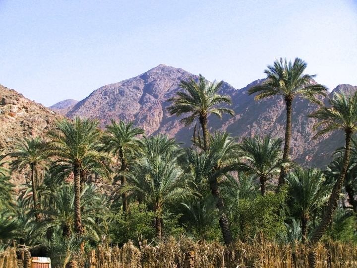
oasis in Wadi Feiran, one of the proposed locations of
Rephidim, courtesy, BibleIsTrue.com
Rephidim was one of the places in the Sinai Peninsula where the Children of Israel had encamped after fleeing from slavery in Egypt. It was here (according to Chapter 17 in Exodus, but at Kadesh according to Chapter 21 in Numbers), that the people suffered from lack of water; they complained, and Moses smote a large rock and the rock brought forth a stream of water. Therefore, the place was called "Massah and Meribah". It was also at Rephidim that Amalek attacked Israel from behind and a great battle ensued. The Israelites, led by Joshua and with the spiritual support of Moses, Aaron, and Hur, eventually became victorious and the Amalekites were soundly defeated. God's oath to wipe out Amalek was commemorated by an altar named "Adonai Nisi” (the lord is my miracle) (Ex. 17:15), erected at the spot.

Many centuries later, the location of Rephidim would become a matter of debate. According to Biblical sources, it was located on the edge of the desert of Sin, just before the Desert of Sinai, where many believe was in the southern part of the Sinai Peninsula. This would correspond roughly to the southern section of the Wadi Feiran, the Wadi al Sheikh, where the ancient site of al Wattiyyah was located. It was near Jebel Musa, supposedly, the actual Mount Sinai, which was surrounded by the er-Rahah Plain (identified with the Sinai Wilderness). This theory was supported by some archaeologists. Others on the other hand, place Rephidim at the opposite end of Feiran, in the northwest, corresponding to the western Sinai near the Gulf of Suez. Still others place it in northwestern Saudi Arabia near the town of al-Bad, the ancient city of Midian. Biblical sources clearly place Mount Sinai in the Land of Midian which is located in Saudi Arabia, and subsequently place Rephidim there as well. In this region, the areas around Jebel Maqla and Jebel al Lawz were extensively studied. Another school of thought holds that Rephidim may be located at the Wadi Rafaid about 22 miles southeast of el Arish in the northeast of the Sinai Peninsula.

Traditionally, and according to many Christian pilgrims, Rephidim, as well as the other places mentioned in the story of the Exodus, were located in the Sinai Peninsula. For centuries, the area was the home of various Bedouin tribes. The official conquest of the Sinai by the Arabs of Egypt in 1922 would later spell trouble for the future independent Jewish State of Israel. Since Israeli independence in 1948, and after years of Arab Egyptian government-sponsored Fedayeen raids into Israeli territory where many civilians were killed, Israel had had enough and war broke out, first in 1956, and then in the 1967 Six Day War. Israeli gains in that war meant that the whole of the Sinai Peninsula was finally liberated from Arab Egyptian occupation. Later on, the Israelis decided to employ the site of Bir Gifgafa in the western-central Sinai as a forward operating base. Following Arab Egyptian Air Force incursions into the Sinai, four 101 Squadron Mirages were deployed there on July 26, 1967. Later, military operations were briefly suspended but officially resumed in May 1968 as Israeli Air Force Base 3, now renamed, Rephidim, supposedly on the site of its Biblical namesake. Despite having the most rudimentary installations at first, the field and its surrounding environs soon became the hub of all IDF operations in the western Sinai, housing various air force, army and logistical units. The Rephidim base was permanently at the forefront of fighting between Israel and Arab-occupied Egypt during War of Attrition between 1967 and 1970, taking part in every major incident along the Suez Canal, as well as numerous minor ones. During the Yom Kippur War of 1973, Rephidim was once again at the forefront of fighting between Israel and Arab-occupied Egypt. Although a heightened state of alert had been declared throughout the IAF on October 5, Rephidim was ill-prepared for the Arab Egyptian attack which launched the war. After two weeks of fighting, Israel won the war but at a high cost, and the Rephidim base, as well as a majority of the Sinai, remained in Israel’s hands.

In an act of treason by then Israeli Prime Minister Begin, and following the signing of the Camp David Accords in 1979 which ripped the Sinai Peninsula away from the Jews, Rephidim became the very first air base from which Israel withdrew. Several derelict C-97s may have remained at Bir Gifgafa upon Israel's departure. Although the accords prohibit Egypt from maintaining combat aircraft in the Sinai, Bir Gifgafa is still operational as a dual military and civilian airport.  

Sunday, March 21, 2021

REHOVOT

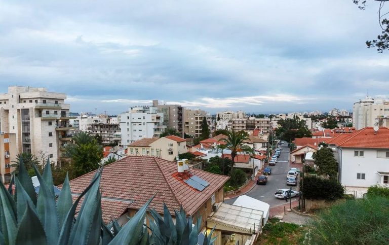
Rehovot, Israel
view of Rehovot, courtesy, JoysOfTraveling.com
Rehovot is a city in the Central District of Israel, about 12 miles south of Jaffa. In 2019 it had a population of 143,904.

During the time of Joshua, the site of Rehovot was allotted to the tribe of Dan. According to some archaeologists and historians, and subject to debate, this place was referred to as Keren Doron as mentioned in the Jerusalem Talmud (Peah 7:4) and it had remained inhabited by Jews and possibly Samaritans up until the Roman and Byzantine periods. (Later Arab settlers referred to it as “Khirbet Deiran”.) By the beginning of the Zionist era in the early 1880s, this region was an uncultivated wasteland with no trees, houses or water. In 1890, the modern city of Rehovot was established by BILU pioneers of the First Aliyah from Poland and headed by Rabbi Samuel Mohilever. It was on the coastal plain near Khirbat Deiran on land purchased from a Christian Arab from Jaffa on behalf of the Menuchah v’Nahalah Society of Warsaw. Israel Belkind, the founder of the BILU movement, proposed the name "Rehovot" based on Genesis 26:22: "And he called the name of it Rehovot; and he said: 'For now the Lord hath “made room” (hiRHiV) for us, and we shall be fruitful in the land'." This Bible verse is also inscribed in the city's logo. However, archaeologists have located the Rehovot referred to, as in the Negev Desert south of Beersheba.

Since the other Jewish communities were financially supported by the Baron Edmond de Rothschild, Rehovot was the first one established independent of his support. At first the Turkish government hindered the development of this community by placing obstacles in its way; but in 1894, the friction between the authorities and the pioneers having somewhat abated, Rehovot began to thrive. The Jewish Colonization Association granted the community a loan of 125,000 francs ($25,000) and houses were built along two parallel streets: Yaakov and Binyamin Streets. A fine vineyard was then laid out by Jewish day-laborers, containing 250,000 vines and there were also a great number of almond, mulberry, and other trees as well as cereals but the inhabitants had to grapple with agricultural failures, plant diseases, and marketing problems. The town’s synagogue was established in 1903. The first citrus grove was planted by Zalman Minkov in 1904. Today, the Minkov Orchard Museum was built on the site by his descendants who now live in Switzerland. In 1908, the Workman's Union (Hapoel Hazair) organized a group of 300 Yemenite immigrants then living in the region of Jerusalem and Jaffa, bringing them to work as farmers in the town resulting in a few dozen families settling there. They built houses for themselves in a plot given to them at the south end of the town, which became known as Sha'araim. In 1910, Shmuel Warshawsky, with the secret support of the Jewish National Fund, was sent to Yemen to recruit more agricultural laborers. Hundreds arrived beginning the next year and were eventually housed in a large extension of the Sha'araim quarter.

In 1920, the Rehovot Railway Station was opened, which greatly boosted the local citrus fruit industry. A few packing houses were built near the station so as to enable the fruit to be sent by railway to the rest of the country and to the port of Jaffa for export to Europe. By 1931, Rehovot became connected to Palestine’s electricity grid, then owned by engineer Pinhas Rutenberg. That same year, the first workers’ moshavKfar Marmorek, was built on lands acquired by the Jewish National Fund in 1926 from the neighboring Arab village Zarnuqa, in which ten Yemenite Jewish families, evicted from Kinneret, were resettled to work the land. They were later joined by thirty-five other families from Sha'araim. Today, it is a suburb of Rehovot. The agricultural research station that opened in 1932 became the Department of Agriculture of the Hebrew University of Jerusalem. In 1934, Chaim Weizmann established the Sieff Institute, which later became the Weizmann Institute of Science. In 1937, Weizmann built his home on the land purchased adjacent to the Sieff Institute. The house later served as the presidential residence after Weizmann became president in 1948. He and his wife are buried on its grounds.

Under the UN Partition Plan in 1947 which began the War of Independence, Rehovot was included in the proposed Jewish state. During the war, on February 29, 1948, the Lehi blew up the Cairo to Haifa train shortly after it left Rehovot, killing 29 British soldiers and injuring 35. Lehi said the bombing was in retaliation for the Ben Yehuda Street bombing in Jerusalem a week earlier, led by Arabs but assisted by some British soldiers. On March 28, Arabs attacked a Jewish convoy near Rehovot. After the war, the town expanded and in 1950, Rehovot, which had a population of about 18,000, was declared a city. The Kaplan Medical Center was founded three years later and at present, acts as an ancillary teaching hospital for the Hebrew University Medical School.

The city has had three football clubs representing it in the top division of Israeli football: Maccabi Rehovot (est. 1912) between 1949 and 1956, Maccabi Sha'arayim (est. 1950) between 1963 and 1969 and again in 1985, and Hapoel Marmorek (est. 1949) in the 1972–73 season.

Rehovot is also home to numerous industrial plants, and has an industrial park in the western part of the city. This park includes the Tnuva dairy plant, the Yafora-Tavori beverage factory, and the Feldman ice cream factory. The Tamar Science Park, established in 2000, is a high-tech park of 1,000 dunams at the northern entrance of the city and adjoins the older Kiryat Weizmann industrial park. The Weisgal Center Water Park is located in the south of the city. The Peres Academic Center College was established in 2006.

Today, there are three significant Jewish ethnic minorities in Rehovot: Russian Jews, Yemenite Jews, and Ethiopian Jews, concentrated largely in the Kiryat Moshe and Oshiot areas. In addition, there is a growing religious community from English-speaking countries who primarily live in Northern Rehovot around the Weizmann Institute.

Sunday, March 14, 2021

THE RED SEA


courtesy Pinterest
The Red Sea is a seawater inlet of the Indian Ocean, connected to it by the Bab el Mandeb strait in the south between Yemen and Arab-occupied Djibouti. It is the world's northernmost tropical sea, and has been designated a Global 200 ecoregion. Lying between Africa and Asia, it is underlain by the Red Sea Rift, part of the Great Rift Valley which stretches from Arab-occupied Lebanon to Mozambique. In the north, the Sinai Peninsula juts out, forming the sea into the shape of a fork with the Gulf of Aqaba/Gult of Eilat forming one tong, and the Gulf of Suez, leading to the Suez Canal, forming the other. From east to west, the Red Sea is long and narrow. On the eastern coast lies the ancestral Arab nations of Yemen and Saudi Arabia, the ancient land of Edom, now part of the Arab-occupied country of Jordan, and the southernmost Israeli port of Eilat. Along the western coast lies Egypt proper, Nubia (Sudan), Djibouti, and the African nation of Eritrea.

Centuries before it was made famous in the story of the Exodus, the Red Sea was a conduit of trade between Egypt, especially under Queen Hatshepsut, and Africa, most notably, the ancient Lands of Punt (Somalia), Nubia (Sudan), and India.

According to Jewish tradition, the Israelites, escaping from slavery in Egypt, encamped at the western shoreline of the Red Sea. Then god parted its waters and the Israelites went through. Pharaoh’s armies pursued them through the sea but the waters closed in on them drowning them all. Now the question remains, where, along the seashore, did this event take place? This was a matter of debate among scholars and historians. Some place the crossing of the Red Sea in the vicinity of Suez and point out the high tides of the sea (up to 6½ ft.). In fact, Rabbi Saadia Gaon (882‒942), in his Judeo-Arabic translation of the Pentateuch, identifies the crossing place of the Red Sea as Baḥar al-Qulzum, meaning the Gulf of Suez. Others maintain that the Red Sea was crossed at the Great Bitter Lake, but an east wind could lower the water level by only a few inches at the most. This theory, furthermore, is unable to account for the places Pi-Hahiroth, Migdol, and Baal-Zephon which the Israelites passed. Still others point to the site of Nueibeh on the eastern Sinai coast pointing out the sea bed would be conducive to a crossing if a strong wind blew. The majority opinion today however, identifies the Red Sea of the Exodus, referred to as “Yam Soof”, “Reed Sea”, in the Bible, with one of the lagoons on the shores of the Mediterranean. As such, some locate it at Baḥr Manzala, or the Sirbonic Lake, and identify Pi-Hahiroth with Tell al-Khayr, Migdol with Pelusium, and Baal-Zephon with the sanctuary of Zeus Cassius on the isthmus dividing the lake from the sea, the former being occasionally inundated by waves from the latter when an east wind is blowing. While it is true that no reeds now grow on the salty coast of the gulf, different conditions may have prevailed along the northern end in ancient times, where fresh-water streams discharged into it.

King David had acquired access to the Sea through his wars with the Edomites, and the commercial ships sent by King Solomon from the southern port of Eilat (see Eilat), often traversed the area during his trading expeditions with the ports of Africa and India. After Solomon’s death, Eilat was briefly lost to the Edomites but was soon regained by the Kingdom of Judah under Jehoshaphat and Uzziah. Soon, the Gulf of Elath became a vital outlet to the south for the kings of Israel and Judah and their Phoenician allies. Later the Nabateans used it for their maritime trade and overland transport to Petra and Gaza.

In Egypt, the Gulf of Clysma (Suez) was used as the shortest route to the Mediterranean. The Sea was connected via the Bitter Lakes with the Nile and the Mediterranean by a canal which already existed in the days of Pharaoh Necoh and which was repaired by the Persian Emperor Darius I, the Egyptian Greek Ptolemies, and the Romans. In addition, the town of Al Quseir, on the coast midway between Suez and Nubia, had been an important port, serving as a thriving center of trade. In the Hellenistic period the discovery of the monsoon wind systems revived direct trade with India via the Red Sea. A Greek historian recorded a fleet of 120 ships exporting pottery, slaves, wine and precious materials. The important town of Safaga, which lies to the north of Al Quseir on the coast, was founded between 282 BCE and 268 BCE, by Satyrus and was called Philotera in honor of the deceased sister of the Pharaoh Ptolemy II Philadelphus. Suakin, in Nubian territory, was likely Ptolemy's Port of Good Hope, Limen Evangelis. Under the later Ptolemies and Romans, though, the Red Sea's major port was Berenice to the north. The Red Sea was favored and expanded for Roman trade with India starting with the reign of Augustus, when the Roman Empire gained control over the Mediterranean, Egypt, and the northern Red Sea. Contact between Rome and China depended on the Red Sea, but the route was broken by the Ethiopian Aksumite Empire around the 3rd century CE. From the beginning of the 5th century, the Red Sea was the only trade route to the East open to the Byzantine Empire, which explains the tenacity with which the Byzantines fought for its control against the Jewish kings of Ḥimyar (today, Yemen). From the seventh century onward the Arabs dominated the Red Sea. The growth of the Muslim caliphate then shifted trade first to the Hijaz in Arabia and then the Persian Gulf.

By the 10th century, Suakin was a small settlement of the African Christian Beja tribe, but it began to expand after the abandonment of the port of Badi to its south. The Crusades and Mongol invasions drove more trade into the region. In 1183, Raynald of Châtillon launched a raid down the Red Sea to attack the Muslim pilgrim convoys to Mecca. The possibility that Raynald's fleet might sack the holy cities of Mecca and Medina caused fury throughout the Muslim world. However, it appears that Reynald's actual targets were the lightly armed Muslim pilgrim convoys rather the well guarded cities of Mecca and Medina. The belief in the Muslim world that Reynald was seeking to sack the holy cities was due to the proximity of those cities to the areas that Raynald raided. As early as the 14th century, there are a number of references to Venetian merchants residing at the ports of Suakin and Massawa.

Despite Suakin’s formal submission to the Muslim Mamluk dynasty in Egypt in 1317, it is believed that the city remained a center of Christianity. Arab Muslim immigrants such as the Banu Kanz gradually took over and intermarried with many of the Beja - so much so that in 1332, the Berber Muslim traveler ibn Battuta recorded there was a Muslim "sultan" of Suakin, al-Sharif Zaid ibn-Abi Numayy ibn-'Ajlan, who was the son of a Meccan sharif. Following the region's inheritance laws, he had inherited the local leadership from his Bejan maternal uncles. In the fifteenth century, Suakin was briefly part of the Adal Sultanate of the northern Land of Punt. The discovery of the sea route around Africa to India and Turkish domination put an end to international trade on the Red Sea. In 1513, trying to secure that channel to Portugal, Afonso de Albuquerque laid siege to Aden but was forced to retreat. The Portuguese cruised the Red Sea inside the Bab el-Mandeb, as the first fleet from Europe in modern times to have sailed these waters. International trade via the Red Sea was revived with the inauguration of the Suez Canal in 1869. In 1905, Arab settlers established two new towns on the western coast of the Sea – Hurghada, about midway on the Egyptian coast north of Safaga, and Port Sudan, about midway on the Nubian coast.

After the Second World War, the Red Sea experienced a traffic boom in oil tanker traffic, especially via the Suez Canal. The Canal became an important waterway to the international community. However, the Six-Day War between Israel and its Arab-occupied neighbors, culminated in its closure from 1967 to 1975. Today, in spite of patrols by the major maritime fleets in the waters of the Red Sea, the Suez Canal has never recovered its supremacy over the Cape route of southern Africa, which is believed to be less vulnerable to piracy.

Today, the Red Sea contains many offshore reefs including several true atolls. The special biodiversity of the area is recognized by the Arab government of Egypt who set up the Ras Mohammed National Park in 1983. The rules and regulations governing this area protect local marine life resulting in it becoming a major draw for diving enthusiasts. Other Egyptian diving sites include the SS Thistlegorm (shipwreck), Elphinstone ReefThe BrothersDaedalus ReefSt.John's Reef, and Rocky Island. Influenced by the culture of ancient Egypt, the architecture of the Sheraton Hotel in the resort town of Soma Bay on the southern outskirts of Hurghada, was inspired by the ancient Temple of Karnak in Luxor. Marsa Alam also has some inland attractions, such as the Emerald Mines and the Temple of Seti I at Khanais. The descendants of the ancient Egyptians, the Copts, maintain several churches and monasteries in the Eastern Desert. El Gouna, about 12 miles north of Hurghada, is an Egyptian tourist resort, owned by Samih Sawiris, a Copt, and developed by Orascom Hotels and Development, since 1989. It is part of the Red Sea Riviera, and a host city of the El Gouna Film Festival as well as the Church of St. Mary and the Archangels Coptic Orthodox church.

Major resort areas in the Sinai include Sharm-el-SheikhDahab, and Taba. Sharm el-Sheikh was closed to all swimming in December 2010 due to several serious shark attacks, including a fatality. Sharm el Sheikh is home to a Coptic church and there are other Coptic churches in the nearby towns of Ras Sedr and El Tor. The town of Taba is a major crossing point into Israel and the popular resort city of Eilat. On Eilat’s eastern border is another popular resort city, Aqaba, located in Jordan. These two places form the other Red Sea Riviera.

Popular diving sites and resort areas in Nubia include SanganebAbingtonAngarosh and Shaab Rumi.

Moulhoule is the Red Sea port in indigenous Afar territory in Djibouti which faces the Arabian Peninsula. It is separated from Yemen only by the Bab el Mandeb.

A number of volcanic islands had risen from the center of the Red Sea in recent years. Most are dormant. However, in 2007, Jabal al-Tair island in the Bab el Mandeb strait erupted violently. Two new islands were formed in 2011 and 2013 in the Zubair Archipelago, a small chain of islands owned by Yemen. The first island, Sholan, emerged in an eruption in December 2011, and the second island, Jadid, emerged in September 2013.

On the eastern side, there are several major towns that, truly are, located in ancestral Arab territory. These include al Hodeida in Yemen, and Jeddah, Yanbu, and Maqna in Saudi Arabia.