For the record, I'm neither an academic nor a scholar, and admittedly, I've never been to many of the places posted here. So if someone should find a mistake, or believe I omitted something, please feel free to email me and I'll correct it.

I can be contacted at dms2_@hotmail.com.

Showing posts sorted by relevance for query gilead. Sort by date Show all posts

Monday, April 13, 2020

GILEAD

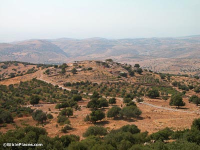
site of Tishbi in Gilead, home of the Prophet Elijah, courtesy, BiblePlaces.com
Gilead was an ancient region lying on the east side of the Jordan in what is today, the Arab-occupied Hashemite Kingdom of Jordan. It was also the site of a town of the same name where a treaty was proclaimed between Jacob who, with his family, had fled from the house of Laban his father-in-law in Aram Dimashq, and Laban himself. After the Exodus and Joshua’s conquests, the region of Gilead was allotted mostly to the tribe of Gad with the remainder going to the half-tribe of Menasheh. The town of Ramot Gil’ad, according to Joshua 20:8, became one of the Levitical cities as well as a city of refuge. Yavesh Gil’ad was the principal city and first mentioned in connection with the war between the Benjaminites and the other tribes of Israel. Because the local Gadites had refused to march against the Benjaminites, 12,000 Israelites were sent against them. All the people of the city were slain except 400 virgins who were spared only to be given as wives to the surviving Benjaminites. In the beginning of the reign of Saul, the city was attacked by Nahash, King of Ammon, and was forced to apply to Saul for help. The inhabitants of Yavesh Gil’ad remained grateful to Saul for his assistance, and when he and his three sons were killed by the Philistines on Mount Gilboa, they went by night, took the bodies from the wall of Beth She’an, brought them to Yavesh, burned them, buried the remains, and fasted seven days. For this deed, Yavesh Gil’ad was afterward highly lauded. Much later, during the period of the divided Kingdom, there preached the Prophet Elijah, a native of the town of Tishbi located in Gilead.


During the Islamic period, the territories on the east side of the Jordan, being so close to the Arabian Desert, were one of the first of the ancient Israelite territories to be settled by Arab tribes, and throughout the centuries, both Arab and Jewish Bedouin would traverse the area.

Ajlun (the Arabic name for Gilead) was an important Jewish center in the Middle Ages. In the 12th century, the Spanish Jewish traveler and explorer Benjamin of Tudela wrote of a Jewish community in Ajlun with a population of 60 families lead by three sheikhs – Zadok, Yitzhak, and Shlomo. For a period of time, the rabbis of Jerusalem debated whether certain parts of the territories east of the Jordan, including Ajlun, were part of the Land of Israel according to halacha, and therefore subject to the laws that can only be observed in Israel. People often expressed their opinions, but one opinion that carried much weight was that of the Palestinian geographer Ashturi HaParhi who considered the town as part of Israel. The matter was finally settled at the end of the 16th century when Ajlun, along with other towns in the area, were officially considered a part of Israel according to halacha. (NOTE: At that time, whether a rabbinic authority was pro or con, no one even discussed the possibility of uprooting Jews from there. And the Jews from there never said that they were there in order to protect Jaffa.)

In 1879, the region was proposed as a place of Jewish settlement by the English adventurer Laurence Oliphant. By that time, Ajlun had long been abandoned but there was still an intermittent Jewish presence in the region among the local Bedouin. Many Jews would come to Jerash, for example, for trade making that town, a major commercial center, a status it retained until the 1920s.

In the 1890s, one of the earliest halutzim, Isaiah Rafalovich, lived for a while in es Salt. During World War I, the Battle of es Salt, one of many battles that were fought in the Gilead region, and fought between the Turks and the Jewish Legion, was among the most decisive battles in the War that allowed the British to take control of Palestine. When the British authorities created Transjordan in 1922, the territories east of the Jordan, including Gilead, became off limits to Jews. Today, in spite of the peace treaty with Jordan, the ban on Jewish residency in the area is still in force.

Friday, February 21, 2020

TRIBE OF GAD

territory of Gilead, Tribe of Gad, courtesy, Wikipedia
According to the Torah, the tribe of Gad consisted of the descendants of Gad the seventh son of Jacob by Zilpah, handmaid of Leah who considered his birth to be fortunate, hence his name which, in Hebrew, means “fortune”. In the Talmudic account, he was born on the tenth of Ḥeshvan, lived to the age of 125 and was buried in Ramia, in the future portion of his tribal territory on the east bank of the Jordan. A genealogy of the "children of Gad" is also set out in 1 Chronicles 5:11-17. It has been said that the prophet Elijah was a descendant of Gad.
During the Exodus from Egypt, the tribe was credited with the raising of 40,000 men able to bear arms. Before the Children of Israel crossed over the River Jordan to the Promised Land, the tribe of Gad along with Reuben and half of Menashe insisted to Moses that they settle on the east side of the river where the pastureland was good. Moses agreed on the condition that they helped in the conquest of the land to which they agreed. According to Numbers 32:33-36, Moses allocated to Gad the land in the central region between Menashe on the north and Reuben on the south. “And Moses gave unto them, even to the children of Gad, and to the children of Reuben, and unto the half-tribe of Manasseh the son of Joseph, the kingdom of Sihon king of the Amorites, and the kingdom of Og king of Bashan, the land, according to the cities thereof with their borders, even the cities of the land round about. And the children of Gad built Dibon, and Ataroth, and Aroer; and Atroth-shophan, and Jazer, and Jogbehah; and Beth-nimrah, and Beth-haran; fortified cities, and folds for sheep.” Other cities built, as described later on in the Book of Joshua were Bet Aram, Betonim, Mahanaim, Ramat Mitzpe, Succot, and Zaphon.
The tribal location was never secure from invasion and attacks, since to the south and east it was exposed to the Moabites, Ammonites, Kedemites, Hagarites, and like the other tribes east of the Jordan, to Aram-Damascus and later the Assyrians. From the conquest of the land by Joshua until the formation of the first Kingdom of Israel in c. 1050 BCE, the Tribe of Gad was part of a loose confederation of Israelite tribes. No central government existed, and in times of crisis the people were led by ad hoc leaders known as Judges (see the Book of Judges). During the era of the Judges, the submission of the people of Succoth and Penuel to the Midianites and the Kedemites led them into a fratricidal war with Gideon but the Gadites of Gilead, the Gileadites, were saved from the Ammonites by Jephthah (Judg. 11). At this time the Gileadites and the Benjamites entered into marital ties and a fraternal alliance (Judg. 21). With the growth of the threat from Philistine incursions, the Israelite tribes decided to form a strong centralized monarchy to meet the challenge, and the Tribe of Gad joined the new kingdom with Saul as the first king. After the death of Saul, all the tribes other than Judah remained loyal to the House of Saul with his son Ish-boshet as king. Ish-boshet ascended the throne at Mahanaim which was in Gadite territory. But after the death of Ish-boshet, the Tribe of Gad joined the other northern Israelite tribes in making Judah's king David the ruler of a re-united Kingdom of Israel. David's wars with Aram, Ammon, and Moab greatly strengthened the position of Israelite Transjordan and years later, Mahanaim became his base in his war against Absalom (ii Sam. 17:24–27; 19:33). Mahanaim later became the station of one of Solomon's 12 commissioners (i Kings 4:14). However, on the accession of Solomon’s son Rehoboam, in c. 930 BCE the northern tribes, including Gad, split from the House of David and from Saul's tribe Benjamin to re-form Israel as the Northern Kingdom. When King Mesha of Moab rebelled against Israel, he dealt harshly with the Gadites of Ataroth. The Gileadites suffered greatly from the Arameans and the Ammonites during Israel's weakness in the first half of the rule of the House of Jehu, but Gilead was reconquered by King Jeroboam II during whose reign, there seems to have been a period of respite in their history (ii Kings 14:28; cf. i Chron. 5:17). There are allusions to some sort of ties between Gilead and the kingdom of Judah during the reign of Jotham king of Judah, on the eve of the destruction of Gilead (i Chron. 5:17; ii Chron. 27:5).
In 732 BCE, the territory of Gad was laid waste by Tiglath Pileser III, king of Assyria, and most of its inhabitants were exiled from their land (ii Kings 15:29), which was then invaded by the Ammonites (Jer. 49:1). However, there are indications that a remnant of the Gadites remained in southern Gilead, and it is possible that the Tobiads known at the beginning of the Second Temple period derived from them. The Gadite remnant and the Judean refugees in Ammon (Jer. 41) formed the foundation of the Jewish community that developed in Transjordan in the days of the Second Temple.
Officially though, the tribe of Gad was henceforth counted as one of the Ten Lost Tribes of Israel. However, the Igbo Jews of Nigeria claim descent from Gad as well as other Israelite tribes such as EphraimNaphtaliMenassehLevi, and Zebulun. But historians tend to dispute this theory. The Igbo on the other hand, remain insistent and the debate continues to this day.
For a subsequent history of the Israelite tribal territories east of the Jordan, see posting on the Hashemite Kingdom of Jordan.

Sunday, April 7, 2019

THE HASHEMITE KINGDOM OF JORDAN

Image result for landscape of gilead in jordan
courtesy commons.wikimedia.org

The Hashemite Kingdom of Jordan is today an Arab country, approximately the size of Indiana with a population of about 8 million. It is actually more an invention than a country. Historically, the northwestern quarter made up the Israelite tribal territories of Reuben and Gad, to the south and immediately to the east was the ancient kingdoms of Moab, Edom, and Ammon. The rest was part of the Arabian Desert. After World War I, the victorious British united all these lands as well as the lands to the west of the river, all of which, had already been designated as the borders of the revived Jewish National Home. However, in 1922, the British authorities separated the area from the part of Palestine that was west of the Jordan River and created a new Palestinian Arab country known as the Kingdom of Transjordan because its lands lie across the Jordan River. It acquired its present name at the end of 1948.    

NOTE: Jordan is probably the most stable of all Arab countries today, but even here, Islamic extremists have their ardent supporters. So wherever you travel in the country, use caution and be aware of your surroundings.
In ancient times, this area was partially made up of the ancient Israelite/Jewish territories of Gad, Reuven, and the eastern half of Menasheh (which also extended into, what is today, southwestern Syria). In this area are the sites of Mount Nebo (burial place of Moses), Abel Shittim (today, the town of Abila where the Israelites camped before crossing the river into the Land of Canaan), and Penuel where Jacob stopped on his way to Padan Aram in Syria and, after wrestling with an angel, received as a blessing, the name of “Israel,” an acronym meaning “because you fought with God.” It is an irony that the name “Israel” was first coined at a site that is located in what is today, an “Arab Palestinian” Kingdom.
South and east of the ancient Israelite territories were the non-Israelite territories of Ammon, centered in and around, what is today, Amman, and Edom and Moab. The inhabitants of these places were long extinct though some say that their descendants do actually live on as the local bedouin. East of these territories, the region was often referred to in the Bible as the “East Country”, part of the Nabatean Arab homeland.
Since the biblical period and until the early Middle Ages, Israelites/Jews continued to inhabit their ancient ancestral lands east of the Jordan. With the Arab conquest and occupation in the 7th century, this territory, being so close to the Arabian desert, was the one of the first in Palestine to experience Arab colonization, settling alongside the indigenous Jewish inhabitants. The town of Ajlun, the biblical Gilead, had long been a prominent medieval Jewish center. At one point, there was question among the rabbis in Jerusalem over whether Ajlun and the entire region was halakhically a part of the Land of Israel. At the end of the 16th century and after much debate, they decided in the affirmative and the local Jews were henceforth able to observe those Jewish rites that can only be practiced in the Land of Israel. (At that time, no one ever suggested that Jews were there in order to protect Jaffa.)
This rabbinic ruling, however, was over a region that became devoid of Jews as during and after the Crusader period, bedouin raids and depredations drove the local Jews away. But sacred land is sacred land and the empty lands east of the Jordan were treated just as holy as the lands west of the Jordan and Jewish travelers and merchants still maintained an intermittent Jewish presence in the region.
In 1879, the lands east of the Jordan was proposed as a place of Jewish settlement by the English Christian adventurer Laurence Oliphant as a first step towards Israel’s restoration to its ancestral land. At the end of the 19th century and the beginning of the 20th, Zionist organizations in New York, Montreal, Chicago, Romania, and Yekatrinoslav, purchased land in the area for this purpose. However, no appreciable settlement followed. During World War I, the Battle of es-Salt between the Turks and the Jewish Legion, just 16 miles west of Amman, was among the most decisive battles in the War that allowed the British to take control of Palestine.
In 1919, as part of post-war international peace deals, Zionist leaders proposed the border of Palestine as including all of the ancient Israelite territories plus Moab and Edom — one of the few things the Zionists actually did right. But the British had other ideas and instead, created their own borders. Upon the creation of Jordan, Jewish habitation in Jordan was decreed off limits, especially in regards to the ancient Israelite territories. This prohibition is still upheld today, as it is in the rest of this “Arab Palestinian” kingdom.
Sites in the Israelite section of Jordan:
Penuel – where Jacob stopped on his way to Padan Aram in Syria and, after wrestling with an angel, received as a blessing, the name of “Israel,” a Hebrew acronym meaning “because you fought with God.” (It is an irony that the name “Israel” was first coined at a site that is located in what is today, an “Arab Palestinian” Kingdom.)
Gilead – today the town of Ajloun, the ancient Gilead home of the Balm of Gilead. The town was the birthplace of the Prophet Elijah
Mount Nebo – burial place of Moses. Other mountains that served prominently in the story of the Exodus from Egypt were Mts. Abarim, Pisgah, and Peor
Jordan River and valley, half lies in Jordan and half lies in Israel. It contains the sites of Abel Shittim today, the ruined site of Abil ez Zeit just a few miles north of the Dead Sea, where the Israelites encamped before conquering the land of Canaan on the west side of the Jordan River, and Bethabara, believed to be the place where John was baptized and conducted his ministry. A tributary of the river is the Jabbok, today, known as the Wadi ez Zaka, where Jacob crossed when returning from Padan Aram to Canaan.
Mahanaim – the Gileadite town that was the hiding place of King David during Absalom’s rebellion
the ancient synagogue of Gerasa, today the town of Jerash
the ancient synagogue of Gadara, today the town of Umm Qais
es-Salt – the site of a World War I victory of the Jewish Legion (attached to the British army) over the Turks. In the 1890’s, the town briefly served as the home of photographer Isaiah Rafalovich
the Dead Sea is the lowest place on earth but is lined, on both its eastern and western shores, with small resorts and beachside clubs; the Arnon River juts out from the Dead Sea and formed the southern boundary of Reuben. Today, it is called Wadi el Mojib

Sunday, June 14, 2020

JABBOK RIVER

Landscape of Jordan.JPG
Jabbok River Valley, courtesy, Wikipedia
The Jabbok River is one of the principal tributaries of the Jordan, flowing from that river’s east bank in the Arab-occupied Kingdom of Jordan about midway between the Sea of Galilee in the north and the Dead Sea in the south. In the course of its 65 mile length, it passes south of the cities of Gilead (Ajlun), Gerasa (Jerash), and Mafraq, finally ending in the northern deserts of the East Bank near the border with Arab-occupied Syria. According to the Book of Genesis, in the hamlet of Penuel in the Jabbok River Valley, Jacob struggled with the angel after his escape from his father-in-law in Syria, and later, it is mentioned in connection with the meeting between Jacob and Esau. The Jabbok was also the scene of an important battle between the Israelites and the Amorites. According to Numbers 21:22-24, Sihon, King of the Amorites, refused to allow the tribes of Israel to pass through his land on their way to Canaan and instead, sent an army against them. “And Israel smote him with the edge of the sword, and possessed his land from Arnon unto Jabbok…” After the Israelites settled in the Promised Land, the Jabbok served as the border between the tribes of Gad and Reuben and the Kingdom of Ammon, today, the land in and around Amman. Some time during or after the Babylonian Captivity, the Jewish family of Tobiah ruled Ammon and that dynasty continued to rule this area until the time of the Maccabbees.

Over the centuries, Arab settlers migrated to the river valley from the Arabian Peninsula, especially after the Crusader period. However, Jewish travelers, merchants, and explorers still traversed the area. Ashturi haParhi in the 14th century and Yehoseph Schwarz in the 19th would make in-person researches on locations of Biblical sites and have identified the Jabbok River with, what the settlers called, the “Zarqa”. Scholars tend to disagree as to why the river received this name. Schwarz states that the Arabs named it the Zarqa because it touched the fortress of Zarqa which was on the route between Damascus and Mecca. But nowadays, the general opinion is that the Jabbok was given this Arabic name on account of the bluish color of its water (“Zarqa” is the Arabic word meaning “blue”).

Today, Jews are prohibited from residing in any part of the river valley as they are in the rest of the Kingdom of Jordan.

Sunday, November 1, 2020

TRIBE OF MENASHE

the eastern part of Menashe today, courtesy, BiblePlaces.com
For previous postings about parts of Menashe, see Samaria and Bashan/Golan Heights.

Menasheh was born in Egypt, the first born of Joseph by Osnat, daughter of Potiphar, priest of On. According to Genesis 41:51, Joseph named him “Menasheh” because “…god has made me forget (נשני Nashani  ) all my toil…” referring to the time when he was sold by his brothers to a caravan going to Egypt, and his subsequent imprisonment in Egypt. The Bible refers to the descendants of Menasheh as a “half tribe”, probably because he was not the son of Jacob. By the time the Children of Israel were on the edge of the Promised Land, Menasheh was divided into east and west. The eastern portion of the tribe settled in their lands first. In Numbers 32:33 and 39, it is stated that eastern Menasheh took possession of the lands of Gilead and Bashan, which stretched as far as the town of Edrei in the east and, what is now known as the Golan Heights in the west. The cities of eastern Menasheh are listed in scattered places in the Bible, but mainly in Numbers 32:41 and Joshua 13:30-31: Ashtarot, a royal city of Bashan, Edrei, another royal city where Og, King of Bashan, was defeated and his lands given over to Menasheh, Golan, set aside by Joshua as a city of refuge and was held by the Gershon branch of the Levites, the Havot Yair bloc, Nobah, and Salchah. Of Salchah nothing is known but the fact that it was a boundary city.

The western portion of the tribe took possession of its land during the time of Joshua. Roughly, this territory consisted of the lands from the Carmel mountain range and across the Jezreel Valley to the Jordan, including the towns of Megiddo and Bet She’an in the north, and going southward, until the northern border of Jaffa in the west, the southern border of Shechem in the center, and the southern border of Gilgal in the east, thus, consisting of the bulk of the Jordan Valley. The cities of Menasheh on the west side of the Jordan, many of which were shared with the tribe of Ephraim, are listed in Joshua 17: Bet She’an, Dor, Ein Dor, Ible’am, Megiddo, Michmetah, Taanach, the area that became Haifa, Ein Tappuah, Gilgal, Shechem, and Shomron.

Thursday, July 4, 2019

BASHAN / GOLAN HEIGHTS

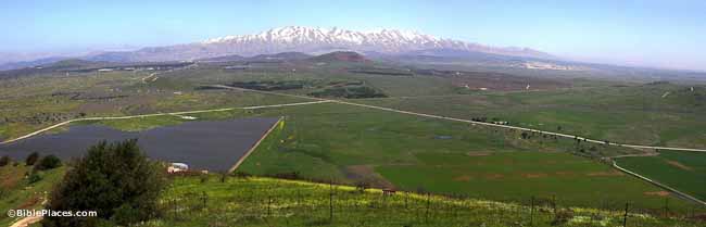
southern Golan Heights, courtesy Wikipedia

In Biblical times, the ancient territory of Bashan, which lies to the east of the Jordan, formed the bulk of the eastern half of the Israelite tribal territory of Menasheh. Today, about half of the territory consists of Israel’s Golan Heights with its “capital” being the revived ancient town of Qatzrin, and the other half in, what is today, the southern half of Arab-occupied Syria but with a large Druze population.

After the Biblical period, this area continued to contain an ancient Jewish community. In the 7th century, while various Arab clans migrated here, the indigenous Jews were joined by Jewish refugees from Khaibar in Arabia, who were expelled by Mohammed, especially the tribes of Kainuka and Wuld Ali, who settled among the native Jews in Edrei, which became a rabbinic center in the Middle Ages. Today, Edrei is known as Deraa, an Arab-occupied town in Arab-occupied southern Syria.
Around the same time, Bashan became home to groups a Druze and Circassians, who came in peace. In time, the Druze became the majority and several settlements including that of Majdal Shams, the ancient Migdal Shemesh, became their main population centers. During the 11th century, there was also a relatively large Jewish community in Banias. They were referred to a Baniasites who were frequently mentioned in the documents of the Cairo Geniza. Eventually, Babylonian Jews as well as a number of Karaites had also settled in Banias, causing the community to divide into Palestinians, Babylonians, and Karaites, who differed in their version of prayers. During the period of Crusader rule, in the early 12th century, the famous proselyte Obadiah the Norman passed through the town and wrote of a Karaite pseudo-messiah Solomon haKohen who would preach of the coming redemption. But in c. 1170, Benjamin of Tudela mentions no Jews at all and it is possible that the community ceased to exist by then. Later however, Banias was re-inhabited by Jews as were some of the other villages in the Bashan area.

By the early 14th century, Jews inhabited three main areas in Bashan – Banias, Edrei, and Salkhad, and questions arose as to whether these areas, as well as others immediately to the east of the Jordan, were halachically part of the Land of Israel. After constant debate, which lasted for over two centuries, during which time, the Jews of Edrei were forced to leave due to Arab depredations, it was decided in the affirmative, and the area was officially recognized as part of the Land of Israel. During the early Ottoman period, Banias still had a Jewish population as attested by a document from 1624 which mentions the murder of a Jewish physician, Elijah haKohen, by an Arab sheikh. During the 18th and 19th centuries, Druze tribes from Lebanon migrated to the eastern part of Bashan and mainly concentrated in and around the mountain which eventually became known as Djebel Druze. It remains their stronghold til today.

By the 19th century, there were, once again, no Jews left in all of Bashan. It was in fact only sparsely inhabited and the land was largely uncultivated. In 1880, Laurence Oliphant published “Eretz haGilad” (The Land of Gilead), which described a plan for large-scale Jewish settlement in the Golan, but the Turks snubbed the scheme. In 1886, native born Jews from Safed formed the Bnei Yehuda Society and purchased 14,000 dunams of land near the Circassian village of Ramthaniya in the central Golan on which, they attempted to establish the village of Golan b’Bashan. But due to financial hardships and the long wait for a kushan (Ottoman land deed), the village was abandoned after a year. Soon afterwards, the Society regrouped and purchased land next to the Bedouin village of Bir Shaqum in the southern Golan. And thus, the village of Bnei Yehuda was established. Between 1891 and 1894, Baron Edmond James de Rothschild purchase nearly 30 sq. miles of land consisting of 16 villages in the eastern Bashan for Jewish settlement. Most of the land straddled both sides of the Nahr el Allan. Today, this land lies just a few miles from the 1967 lines, inside Syria where Jews are forbidden to live. Also in the 1890s, the Russian Agudat Achim Association acquired land in several locations in the districts of Fiq and Deraa and at Jillin where a farm was built and extensive eucalyptus groves were planted. Other tracts of land were acquired by Jewish organizations based in Romania, Bulgaria, the United States, and England, but Jewish settlement in the area remained slow and tenuous. Meanwhile, Jews had managed to build a road stretching from Lake Huleh to Muzayrib and by the mid-1890s most of the Golan had become owned and cultivated by a variety of peoples. A Jewish village called Tiferet Binyamin was set up on lands at Saham el-Jolan by the Shavei Zion Association based in New York, but the project was abandoned after a year when the Turks issued an edict in 1896 evicting the residents on the grounds that they were not Ottoman citizens. A later attempt to resettle the land with Syrian Jews who were Ottoman citizens also failed.
In 1899, the pasha of Damascus expelled the Jews from all of the Rothschild’s estates. Between 1904 and 1908, a group of Crimean Jews settled in the Bethsaida Valley, initially as tenants of a Kurdish proprietor with the prospects of purchasing the land, but the arrangement faltered and most of the Jewish settlements in the region were abandoned over time either due to Arab hostility and Turkish bureaucracy, diseases, or economic difficulties. Bnei Yehuda was the sole exception.

1920 witnessed the first of a series of Arab pogroms which raged throughout the country resulting the massacres and expulsions of Palestinian Jews whether they were immigrants or not. Bnei Yehuda was one such victim community following an Arab attack. But the land itself was still owned by Jews. Meanwhile, the Palestine Jewish Colonization Association obtained the deeds to the Rothschild lands and continued to manage it, collecting rents from the Arab peasants living there. In the 1920s, the British, who now occupied Palestine succeeding the Ottoman Empire after World War I, began a policy of dividing Palestine among Arab groups. In 1922, the Golan Heights were given over to the newly-formed Arab country of Syria, under French rule, and the rest of eastern Palestine was created into the Hashemite Arab Kingdom of Transjordan, under British rule. Western Palestine became more difficult to divide. Meanwhile, along the eastern shore of the Sea of Galilee, which remained part of western Palestine, Ein Gev and Shaar Hagolan were established in 1937. In 1947, the (largely Arab) Syrian Land Settlement Campaign refused to recognize the PJCA as the legal owner of any land in Syria, and the Syrian government confiscated it without compensation on the grounds that “it was contrary to Syrian policy to allow Jews to own land in Syria.”

In the late 1950s, the PJCA transferred the Golan/Syrian landholding to the Jewish National Fund. Today, the JNF still lay claim to the land. In the period between Israel’s War of Independence in 1948 and the Six Day War in 1967, Syria occupied the Golan Heights and Syrian Arabs constantly harassed Israeli border communities by firing artillery shells from their dominant positions there. In October 1966 Israel brought the matter up before the United Nations. Five nations sponsored a resolution criticizing Syria for its actions but it failed to pass due to a Soviet veto. Aside from this little charade, the Israeli government refused to do anything about the situation. One of the laziest and pathetic of Israel’s officials, Golda Meir, summed up life in Israel’s border communities:

The Syrians seemed bent on an escalation of the conflict; they kept up an endless bombardment of Israeli settlements below the Golan Heights, and Israeli fishermen and farmers faced what was sometimes virtually daily attacks by snipers. I used to visit the settlements occasionally and watch the settlers go about their work as though there’s nothing at all unusual in plowing with a military escort or putting children to sleep – every single night – in underground air raid shelters.

In 1967, Israel uncharacteristically finally decided to do something. After the Six Day War broke out in June, Syria’s shelling greatly intensified. The war on the northern front ended when the Israeli army managed to reunite the Golan with the rest of Israel. Jewish re-settlement in the Golan began soon after the war with the establishment of Merom Golan the following month. By 1970 there were 12 such communities. Today, the area is well developed and consists of many sites: Mount Hermon, the highest point in Israel at around 9000 feet, its Ski Resort and Nature Reserve, the Hermon Stream Nature Reserve, the ruins of Gamla known as the Masada of the north, and its ancient synagogue, the Odem Forest, Nimrod Fortress National Park, the Banias Waterfalls, Hermonit Mountain Reserve, Avital Mountain Reserve, Qatzrin Forest and Park including an ancient synagogue, Nahal Mehsushim Nature Reserve, Betzaida Zachi Reserve, Jordan Park, Magrase Nature Reserve, Yarmouk Nature Reserve (today located in the Kingdom of Jordan) and the River of the same name which forms part of the border between Israel and Jordan, the ancient town of Hamat Gader and its ancient synagogue, al Quneitra (today in the demilitarized zone between Israel and Syria but under Syrian Arab control), and the ancient synagogues of En Nashut, Dabura, Dabiyye, Assaliyye, Zumeimira, Dikkeh, Kanaf, and Qanatir.