For the record, I'm neither an academic nor a scholar, and admittedly, I've never been to many of the places posted here. So if someone should find a mistake, or believe I omitted something, please feel free to email me and I'll correct it.

I can be contacted at dms2_@hotmail.com.

Saturday, June 29, 2019

BALFOUR FOREST, ISRAEL


Image result for balfour forest israel
Balfour Forest, courtesy KKL-JNF, photo: Dennis Zin
In Biblical times, the area that is now the Balfour Forest in the hills west of Nazareth, as with the rest of the Land of Israel, was a well-wooded and well-farmed region and located in the tribal territory of Zvulun. After the destruction of Jerusalem by the Romans in 70 and the consequent occupation and invasions of foreign empires – Arabs, Crusaders, Mameluke Egyptians, and Ottoman Turks, etc., and their havoc on the land, Israel gradually became denuded of any forestry whatsoever with the exception of a few small areas scattered throughout the country. It wasn’t until c. 1870 that Jews started to re-plant trees, further south at Mikve Yisrael outside of Jaffa. Around the same time, the Sursock family, a Greek Christian family resident in Beirut, purchased from the Ottoman government, large swathes of the Jezreel Valley, including the Nazereth hills which was sparsely covered with steppes and shrubberies at the time.

With the founding of the Jewish National Fund in 1901, tree planting and land reclamation became more organized and on a national scale. In 1921, after lengthy negotiations, the Sursock landholdings were legally transferred to the JNF and Kibbutz Ginegar was founded the following year west of Nazareth and at the southern foothills. It was the wish of the JNF as well as of the Jewish leadership that this area be made to look like what it was originally in Biblical times and the idea for the Balfour Forest was born, named after Arthur Balfour, British Secretary of State for Foreign Affairs at the end of World War I, who was sympathetic to Jewish national aspirations in the Jewish ancestral homeland.

This was to be the JNF’s first major forestry project, requiring a large amount of capital. So fund-raising began almost immediately spearheaded by the Balfour Forest Committee based in London and headed by Major George Nathan, assisted by the Marquess of Reading. The funds were then transferred to the JNF and, in 1928, on the barren hilltop north of Ginegar, the planting of the forest commenced attended by Jewish and British officials including Menachem Ussishkin, chairman of the JNF, Sir Alfred Mond, accompanied by Lady Mond, who planted the first saplings, Chaim Weizmann, president of the World Zionist Organization, David ben Gurion, head of the Executive of the Jewish Agency for Palestine, High Commissioner Lord Plumer and Lady Plumer, Harry Sacher of the Palestine Zionist Executive, David Yellin, chairman of the Vaad Leumi (the National Council of Palestine), M. Bernard Baron, and Lady Erleigh. After the ceremonial first planting, labor groups from Ginegar were recruited for the project assisted by labor activists from California. All were in agreement that the forest would be economically beneficial to both Jew and Arab alike. When the forest was inaugurated later that year, it was a festive occasion with speeches which were broadcast to England. Well wishes came in from London including from Balfour himself, Sir Herbert Samuel, the previous High Commissioner of Palestine, the Earl of Reading, former Viceroy of India, and former Prime Minister David Lloyd-George. Chaim Solomon, member of the Jerusalem Municipal Council, then presented the forest in the name of British Jewry to the Jubilee Committee as a “symbol of loyalty to the throne and a token of gratitude for the freedom the Jews have enjoyed in Britain during the King’s reign.” The inauguration ceremony ended with the singing of Hatikvah.

In 1933, a major forest fire occurred. Firefighters from Ginegar, and nearby Nahalal and Afula helped to put out the fire. Its cause was uncertain, but during the Arab intifada of 1936-1939, one of many that would periodically erupt since even before the advent of Zionism, Arab arsonists would torch the forest several times causing extensive damage. In one incident in 1939, an arson attempt was thwarted due to the timely intervention by the Police Inspector of Tiberias.

After the intifada had run its course and the onset on World War II, the forest was well guarded and it quickly recovered – so much so that it became a location of frequent recreational and cultural activities. In 1942, a Biblically theme theatrical performance took place at a natural theater setting in the middle of the forest.

In the 1950s, additional trees were planted by refugees from Europe and North Africa. In 1985, a large grove of trees was planted in memory of William MacRae, a prominent member of the Scottish National Party (Balfour was a fellow Scot) and long-time friend of Israel. He was also Professor Emeritus at the University of Haifa.

Today, the forest is surrounded by villages and towns including Migdal HaEmek on the north and west, Yefe an-Nasariyye on the north, Ginegar on the south, and Nazareth on the east. Part of a popular recreational bike path beginning at Migdal haEmek traverses the forest, and weekly visits are arranged by the Haifa Jewish Hospitality Committee.

Sunday, June 16, 2019

BAGHDAD

courtesy, TheOrthodoxChurch.info
Baghdad is the administrative “capital” of the Arab-occupied territory of Iraq. Recalling the stories of the Arabian Nights (many characters of which aren’t even Arabian), most of Baghdad’s people today (as back then) are Arab Muslim but that doesn’t mean that this city is an “Arab” city.
Conventional wisdom has it that Baghdad was founded in the 8th century by the Arab Abbasid dynasty, but in point of fact, the site of present-day Baghdad was originally an Assyrian site with a Persian minority, occupied for thousands of years before its “founding”. Located deep in the Assyrian Empire, this site was composed of a group of settlements and hamlets, one of which was inhabited by Persians and actually called “Baghdad”, a Persian word of unknown origin. (In ancient times, Persia and Assyria were neighboring empires and the people of one empire would often settle in the territory of the other). When the present city was founded, Arab Muslim settlers began to populate the neighborhoods, along with Persians (most of whom had already adopted Islam), Jews, and the indigenous Assyrians and Syriacs (who had adopted Christianity centuries before). Shortly thereafter, Baghdad entered a Golden Age as the ruling Arabs actually showed respect and tolerance toward the other non-Arab and non-Muslim peoples and the city became a diocese of the Syriac Orthodox Church as well as the seat of the Assyrian Church.
Notable scholars based in Baghdad during this time include:
·         Jabir ibn Hayyan, Persian metallurgist known for his work with practical metallurgy
·         Hnanisho II, Assyrian patriarch who transferred the seat of the Assyrian Church from Seleucia-Ctesiphon to Baghdad in 775
·         Yahya Ibn al-Batriq, Syriac astronomer
·         Yuhanna ibn Masawayh, Assyrian physician
·         Al-Khwarizmi, Persian mathematician
·         Abu Maʿshar, leading Persian astrologist in the Abbasid court who translated the works of Aristotle
·         Banu Musa brothers, Persian engineers and mathematicians
·         Laʿzar bar Sabtha, Bishop of Baghdad, deposed by the patriarch Dionysius of Tel Mahre in 826
·         Bishop Youhanna, appointed to succeed La’zar bar Sabtha
·         Hunayn ibn Ishaq, translator, born an Arab Muslim but converted to Assyrian Christianity thus, joining that community
·         Al-Tabari, Persian scholar, historian, and exegete of the Koran
·         Yusuf Al-Khuri, Assyrian mathematician and astronomer who was hired as a translator by the Banu Musa brothers
·         Abu Bishr Matta ibn Yunus, Assyrian physician and scientist
·         Yahya ibn Adi, Syriac philosopher, theologian and translator
·         Avicenna, Persian philosopher and physician famous for writing The Canon of Medicine, the prevailing medical text in the Islamic World and Europe until the 19th century
·         Omar Khayyam, Persian poet, mathematician, and astronomer most famous for his solution of cubic equations
·         Al-Ghazali, Persian theologian, author of The Incoherence of the Philosophers. His work challenged the philosophers who favored Aristotelianism
In 1258, Baghdad was captured by the Mongols led by Hulegu, a grandson of Genghis Khan. Many quarters were ruined by fire, siege, or looting and most of the city's inhabitants were slain. Afterwards, recovery was gradual. In 1336, Denha II was consecrated Assyrian patriarch in Baghdad thanks to the patronage of the Christian emir Haggi Togai. At the beginning of the 15th century, the Mongols, once again, under the Emperor Tamerlane, ravaged Baghdad and had 90,000 Assyrians beheaded. Again, recovery was gradual. All communities, but especially the indigenous community, were left in a much weakened position, the Assyrians being subject to periodic persecutions by Arabs, the Mameluke rulers of Egypt, and the Ottoman Turks.

A year after the great schism in the Assyrian church in 1552, out of which, was formed the Chaldean Catholic Church, the Chaldean Archeparchy of Baghdad was established as the Metropolitan Archdiocese. Baghdad also became an archeparchy of the Syriac Catholic Church in 1862. In 1898, the Cathedral of Mary Mother of Sorrows was consecrated. It became one of the most important cathedrals of the Chaldean church. In 1918, many Assyrians settled in Baghdad fleeing massacres by the Kurds in the town of Salmas (today, located in the extreme northwestern part of Iran).  

Since 1950, the Chaldean Catholic Church has been headquartered in the Cathedral of Mary Mother of Sorrows. In 1964 the Assyrian patriarch Shimun XXI Eshai, in exile since 1933, decreed a number of changes to church practice including liturgical reform, the adoption of the Gregorian calendar, and the shortening of Lent. These changes, combined with his long absence from Iraq, caused a rift in the Assyrian church which led to schism. In 1968 traditionalists within the church elected Thoma Darmo as a rival patriarch to Shimun XXI Eshai, forming the independent Ancient Church of the East and based in Baghdad.
The neighborhood of Dora was largely uninhabited until the 1950s when Assyrians from Habbaniya started to settle there. Most houses and churches were built during the ‘60s and ‘70s while the booming neighborhood attracted more middle-class families. Prior to the Iraq War the area was home to the largest concentration of Assyrians who boasted a population of 150,000. But even then, they were subject to Arab discrimination and persecution and sometimes, murder. In 2002, a 71-year-old nun was savagely attacked and stabbed to death in a local monastery by extremists, who then beheaded her. Since the war, these incidents only intensified as Assyrians were subject to kidnappings, death threats, vandalism, and house burnings by Al-Qaeda and other insurgent groups, and most of Baghdad’s Assyrians were forced to flee as part of the ethnic cleansing process. Some of the most horrific terrorist incidents included: (2004) Arabs bombed five Chaldean churches, murdering nearly a dozen and injuring close to 100. (2005) Assyrians were thought to be among 14 bound corpses of torture victims found in a city garbage dump. (2006) Arabs bombed a Christian district, killing 16 and injuring many dozens more. (2010) 44 church members and two young priests were slaughtered at the Sayidat al-Nejat Cathedral Syriac Catholic Church when Islamic State of Iraq Fedayeen invaded the church, shooting members and tossing grenades into the congregation. Seven policemen were also killed. (2013) Over two dozen people outside a Chaldean church were massacred by Arab bombers. In a separate incident, an Assyrian market was targeted, killing at least eleven patrons in two blasts. 
Today, there are 1500 indigenous Assyrians of all denominations left in Baghdad who survive in spite of the intense Arab persecutions they have to endure.
Other indigenous sites that were either destroyed or just barely survived the Arab onslaughts include: Caliphs StreetBabel College, the Church of St. Paul and St. Peter, St. George Assyrian Church, Our Lady of Deliverance Syriac Catholic Cathedral, St. John Catholic Church, St. Maria Church, St. Joseph Kerk, St. Jacob Kerk, Church of the Sacred Heart, and the Church of St. James.

Sunday, June 9, 2019

BABEL (BABYLON)

Related image
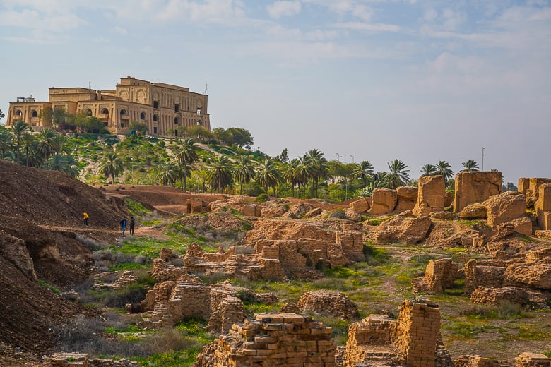
ruins of Babylon, courtesy, unusualtraveler.com
The legendary city of Babylon is today part of the Arab-occupied territory of Iraq. Thousands of years before the Arab occupation, it was the capital and center of the Babylonian Empire. Today, the descendants of the ancient Babylonians are the Iranian Christians, closely aligned with the Assyrian Christians of Iraq, and Babylon itself is an archaeological/historical site, part of the present-day city of Hillah, about 53 miles south of Baghdad. Originally, the Euphrates River bisected the city, but the course of the river has since shifted so that most of the remains of the former western part of the city are now inundated but some portions of the city wall remain. Other parts of the western half have been mined by Arabs for commercial building materials. Some of the nearby ancient settlements included KishBorsippaDilbat, KuthaMarad and Sippar all of them along the Euphrates.
The building of Babylon began many thousands of years ago. It was originally called Babel (as in, the Tower of Babel) a small Akkadian town dating from the period of the Akkadian Empire c. 2300 BCE. In Genesis 10:10, Babel is described as being founded by Nimrod along with UrukAkkad and perhaps Calneh—all of them in the land of Shinar. According to Genesis 11, there was but one human race, speaking one language, migrating to Shinar and eventually establishing a city and the famous tower. Soon, however, the God of the Bible halted construction by scattering humanity across the earth and confusing their language so that they were unable to communicate. Some scholars believe that the tower may have been inspired by a real-life temple, or ziggurat, built to honor Marduk, the patron god of Babylon and son of Shamash, the sun-god of Sippar.
The Akkadian king Šar-kali-šarri laid the foundations in Babylon of new temples for the gods Annūnı̄tum and Ilaba. The town became part of a small independent city-state with the rise of the First Babylonian dynasty in the 19th century BCE. After the Amorite king Hammurabi created a short-lived empire in the 18th century, he transformed Babylon into a major city and declared himself its king, southern Mesopotamia became known as Babylonia and Babylon eclipsed Nippur as its holy city. It has been estimated that Babylon was the largest city in the world c. 1770 – c. 1670 BCE, and again c. 612 – c. 320 BCE. It was perhaps the first city to reach a population above 200,000. 
The empire waned under Hammurabi's son Samsu-iluna and Babylon spent long periods under, and pillaged by, foreign empires such as the Assyrians, Hittites, Kassites, and Elamites. An Akkadian south Mesopotamian dynasty then ruled for the first time. However, Babylon remained weak and subject to domination by Assyria. Its ineffectual native kings were unable to prevent new waves of foreign West Semitic settlers from the deserts of the Levant, including the Arameans and Suteans in the 11th century BCE.  
Under the Assyrian emperor Sennacherib, Babylonia was in a constant state of revolt, led by a chieftain named Merodach-Baladan, in alliance with the Elamites, and suppressed only by the complete destruction of the city of Babylon. In 689 BCE, its walls, temples and palaces were razed. Destruction of the religious center shocked many, and the subsequent murder of Sennacherib by two of his own sons while praying to the god Nisroch was considered an act of atonement. Consequently, his successor Esarhaddon hastened to rebuild the old city and make it his residence during part of the year. After his death, Babylonia was governed by his elder son, the Assyrian prince Shamash-shum-ukin, who eventually started a civil war in 652 BCE against his own brother, Ashurbanipal, who ruled in Nineveh. Once again, Babylon was besieged by the Assyrians and eventually surrendered. An Assyrian governor named Kandalanu was then appointed as ruler of the city. After the death of Ashurbanipal, another civil war followed. Babylon, like many other parts of the near east, took advantage of the anarchy within Assyria to free itself from Assyrian rule. Under Nabopolassar, a previously unknown Chaldean chieftain, Babylon escaped Assyrian rule, and in an alliance with Cyaxares, king of the Medes and Persians together with the Scythians and Cimmerians, finally destroyed the Assyrian Empire between 612 BCE and 605 BCE.
With the recovery of Babylonian independence, a new era of architectural activity ensued, particularly during the reign of his son Nebuchadnezzar II (604–561 BCE). Nebuchadnezzar ordered the complete reconstruction of the imperial grounds, including the Etemenanki ziggurat, and the construction of the Ishtar Gate—the most prominent of eight gates around Babylon. Nebuchadnezzar is also credited with the construction of the Hanging Gardens of Babylon—one of the Seven Wonders of the Ancient World—said to have been built for his homesick wife Amyitis. Nebuchandnezzar is also notoriously associated with the Babylonian exile of the Jews from Judea, the result of an imperial technique of pacification, used also by the Assyrians, in which ethnic groups in conquered areas were deported en masse to the capital.
In 539 BCE, the Neo-Babylonian Empire fell to Cyrus the Great, king of Persia, who conquered Babylon. According to 2 Chronicles 36 of the Hebrew Bible, Cyrus later issued a decree permitting captive people, including the Jews, to return to their own lands. Under Cyrus and the subsequent Persian king Darius I, Babylon became the capital city of the 9th Satrapy, as well as a center of learning and scientific advancement. In Achaemenid Persia, the ancient Babylonian arts of astronomy and mathematics were revitalized, and Babylonian scholars completed maps of constellations.
The early Persian kings had attempted to maintain the religious ceremonies of Marduk, but by the reign of Darius III, over-taxation and the strain of numerous wars led to a deterioration of Babylon's main shrines and canals, and the destabilization of the surrounding region. There were numerous attempts at rebellion and in 522 BCE (Nebuchadnezzar III), 521 BCE (Nebuchadnezzar IV) and 482 BCE (Bel-shimani and Shamash-eriba) native Babylonian kings briefly regained independence. However these revolts were quickly repressed and Babylon remained under Persian rule until Alexander the Great's entry in 331 BCE.
Under Alexander, Babylon again flourished as a center of learning and commerce. However, following his death in 323 BCE in the palace of Nebuchadnezzar, a period of chaos and anarchy ensued which virtually emptied the city; most of the inhabitants were transported to Seleucia, where a palace and a temple (Esagila) were built. With this deportation, Babylon became insignificant as a city, although more than a century later, sacrifices were still performed in its old sanctuary.
In the first century, after the death of Jesus Christ, Christians in Syria and Judea faced severe persecution by the Romans and many of them moved east where they joined the ancient Jewish community in Babylon. Of those who moved east was Saint Thomas, a disciple of Jesus. He succeeded in converting the local inhabitants, from the Euphrates to Persia, to Christianity and established their own church which eventually became the seat of the Bishop of the Church of the East for many centuries afterwards. A new Christian culture was developed and the people would speak various forms of Aramaic. This was maintained even when the city came under the rule of the Parthian and Sassanid Empires and Babylon was designated as a province.
In the mid-7th century, Mesopotamia was invaded and settled by the expanding Arab Muslim Empire, and a period of Islamization and Arabization followed. Babylon was dissolved as a province and Aramaic and members of the Church of the East eventually became marginalized. Soon, the last of the inhabitants left and the city fell into ruins. Babylon is mentioned in medieval Arabic writings as a source of bricks, said to have been used in cities from Baghdad to Basra.
In the centuries that followed, travelers and archaeologists from Europe have visited Babylon. This included such people as Pietro della Valle in the 17th century and Pierre-Joseph de Beauchamp in the 18th whose memoir, published in English translation in 1792, provoked the British East India Company to direct its agents in Baghdad and Basra to acquire Mesopotamian relics for shipment to London.
The site of Babylon has been a cultural asset to Iraq since the creation of the modern Arab Iraqi state in 1921. In a bid to cultural appropriation, Iraq officially “protected” and “excavated” the site and Babylonian images periodically appeared on Arab Iraqi postcards and stamps. In the 1960s, a replica of the Ishtar Gate and a reconstruction of Ninmakh Temple were built on site. On February 14, 1978, the Ba'athist government under Saddam Hussein began the "Archaeological Restoration of Babylon Project": reconstructing features of the ancient city atop its ruins. These features included the Southern Palace of Nebuchandnezzar, the Processional Way, the Lion of Babylon, and an amphitheater constructed in the city's Hellenistic era. In 1982 the government minted a set of seven coins displaying iconic features of Babylon. A Babylon International Festival was held in September 1987, and annually thereafter until 2002 (excepting 1990 and 1991), to showcase this work. Proposed reconstruction of the Hanging Gardens and the great ziggurat never took place. Hussein installed a portrait of himself and Nebuchadnezzar at the entrance to the ruins and inscribed his name on many of the bricks, in imitation of Nebuchadnezzar. When the 1991 Gulf War ended, Hussein wanted to build a modern palace called Saddam Hill over some of the old ruins. In 2003, he intended the construction of a cable car line over Babylon, but plans were halted by the 2003 invasion of Iraq. Following the invasion, the area around Babylon came under the control of US troops, before being handed over to Polish forces in September. In 2005 the site was handed over to the Iraqi Ministry of Culture.
Known remains include:
·         Palace or Castle, it is the location of the Neo-Babylonian ziggurat Etemenanki and lies in the center of the site.
·         the highest of the mounds at 82 feet located in the southern part of the site is the site of Esagila, a temple of Marduk which also contained shrines to Ea and Nabu.
·         Homera – a reddish-colored mound on the west side. Most of the Hellenistic remains are here.
·         Babil – a mound about 72 feet high at the northern end of the site. It held a palace built by Nebuchadnezzar.

Saturday, June 1, 2019

ATLAS MOUNTAINS (NORTH AFRICA)

Image result for berber villages in the atlas mountains
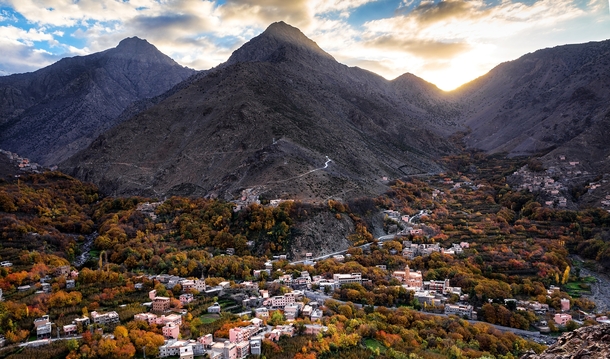
Berber village in the Atlas Mountains, courtesy Photorator

The great Atlas Mountain range in northwestern Africa has long been the homeland (today under Arab occupation) of the indigenous Berber tribes of the Blida, Chenaoui, Chenoua, Chleuh, Kabyle, Sanhaja, Zayane, and the Zenata. It stretches about 1600 miles from the west of Morocco, through northern Algeria, to northern Tunisia and is divided as follows:
The Anti-Atlas, extends from the Atlantic Ocean in the southwest of Morocco toward the northeast to the heights of Ouarzazate and further east to the city of Tafilalt (altogether a distance of approximately 310 miles). In the south it borders the Sahara. The easternmost point of the anti-Atlas is the Jbel Saghro range flanked on its northern border by the High Atlas and includes the Djebel Siroua, a massif of volcanic origin. The Jebel Bani is a much lower range running along the southern side of the Anti Atlas.
The High Atlas, in central Morocco rises in the west at the Atlantic coast and stretches in an eastern direction to the Moroccan-Algerian border. It has several peaks over 2 ½ miles above sea level including the highest summit in North Africa, Toubkal at 13,671 feet, and further east,  Ighil m'Goun (13,356 ft) the second major summit of the range. At the Atlantic and to the southwest, the range drops abruptly and makes a transition to the coast and the Anti-Atlas range. To the north, in the direction of Marrakesh, the range descends less abruptly. On the heights of Ouarzazate the massif is cut through by the Draa Valley which opens southward. From there, the local Berbers would cultivate the high plains of the Ourika Valley. Near Barrage Cavagnac there is a hydroelectric dam that has created the artificial lake Lalla Takerkoust. The lake also serves as a source of fish for the local fishermen.
The Middle Atlas, is completely in Morocco and is the northernmost of the main three Atlas ranges. The range lies north of the High Atlas, separated by the Moulouya and Oum Er-Rbia rivers, and south of the Rif mountains, separated by the Sebou River. To the west are the main coastal plains of Morocco with many of the major cities and, to the east, the high barren plateau that lies between the Saharan and Tell Atlases. The high point of the range is the Jbel Bou Naceur.
The Tell Atlas range is over 930 miles in length, and stretches from Morocco, through Algeria to Tunisia. It parallels the Mediterranean coast. Together with the Saharan Atlas to the south it forms the northernmost of two more or less parallel ranges which gradually approach one another towards the east, merging in eastern Algeria. The area immediately to the south of this range is the high plateau of the Hautes Plaines, with lakes in the wet season and salt flats in the dry.
The Saharan Atlas of Algeria is the eastern portion of the Atlas mountain range. Though not as high as the High Atlas, they are far more imposing than the Tell Atlas range that runs to the north of them and closer to the coast. The highest peak in the range is the 7,336 ft high Djebel Aissa. They mark the northern edge of the Sahara Desert. The mountains see some rainfall and are better suited to agriculture than the plateau region to the north.
The Aures Mountains are an eastern continuation of the Atlas Mountain System that lies to the east of the Saharan Atlas in northeastern Algeria. They have a lower elevation than the High Atlas mountains of Morocco. The highest peak in the Aurès mountain range is Djebel Chélia in Khenchela Province at 7638 feet above sea level. The Belezma Range is a northwestern continuation of the Aures Mountains located where the Tell Atlas and the Saharan Atlas come together. Its main summits are Djebel Refaa (7146 feet) and Djebel Tichaou (7008 feet). Historically, the Aurès Mountains served as a refuge for the Berbers, forming a base of resistance against the foreign occupation of the Roman Empire, the Vandals, the Byzantine Empire, the Arabs, and later, the French.
In ancient times, the kings of Numidia would be buried in the Madghacens in the city of Batna, today, located in northeastern Algeria. The Madghacens were the royal mausoleums, believed to be named after the ancient King Madghacen, common ancestor of the Botri Berbers as well as the Zenata Berbers who became the main inhabitants of the Aures region.
Even though North Africa was invaded and occupied by the Muslim Arabs in the early 8th century during the reign of the Umayyad caliphs, the Zenata, were among the earliest tribes to adopt Islam, in the 7th. The Berbers of the Sousse region also adopted Islam, but gradually and not at the expense of their traditional language, culture and religious customs which they held on to to varying degrees. Eventually, the land that became known as Morocco, came under Umayyad rule but their rule was tenuous due to Berber resistance. In 739 AD an Umayyad Arab army was utterly destroyed twice by the Moroccan Berbers at the battle of the Nobles, and the battle of Bagdoura in the Middle Atlas. In 789 AD, with the approval of the locals, a former Umayyad Arab courtier established the Idrisid dynasty that ruled in Fez. It lasted until 970 AD, as various petty states vied for control over the ensuing centuries. From the 9th century, Sanhaja tribes were established in the Middle Atlas range, in the Rif Mountains and on the Atlantic coast of Morocco and large parts of the Sanhaja, such as the Kutâma, were settled in the central and eastern parts Algeria (Kabylia, Setif, Algiers, Msila) and also in northern Niger. They played an important part in the rise of the Arab Fatimid dynasty.
In the mid-11th century, a group of Sanhaja chieftains returning from the Hajj (pilgrimage to Mecca) invited the theologian Ibn Yasin to preach among their tribes. Ibn Yasin united the tribes in an alliance with the Berber Almoravid caliphate under Yusuf ibn Tashfin, subsequently establishing what we know today, as Morocco. From Morocco, they conquered western Algeria and Al-Andalus (part of present-day Spain).  
The Berber Almohad caliphate was founded by Ibn Tumart, a member of the Masmuda tribal confederation of southern Morocco. Around 1120, the Almohads first established a Berber state in Tinmel in the Atlas Mountains. In 1359 Hintata tribesmen from the High Atlas came down and occupied Marakesh, ancestral Almohad capital, which they would govern independently until 1526. 
Beginning in the 16th century, the Ottoman Empire ruled much of North Africa. During this time, a group a Spanish Muslim refugees settled among the Ouled Soltan of the Blida area. The Zenaga tribes, believed to be descended from the Zenata or Sanhaja, would often suffer exploitation at the hands of the Arabs as either semi-sedentary agriculturalists and fishermen or as Marabouts (religious Muslim leaders and scholars). The Kabyle, on the other hand, were relatively independent of outside control. They lived primarily in three different kingdoms: the Kingdom of Kuku which stretched from the Atlas Mountains to the southern plains of Algiers, the Kingdom of Ait Abbas, and the principality of Aït Jubar. These areas were gradually taken over by the French during their colonization beginning in 1857, despite vigorous resistance. Such Kabyle leaders as Lalla Fatma n Soumer would lead in the resistance even as late as Mokrani's rebellion in 1871. But due to French colonization, many Kabyle emigrated to other areas in and outside Algeria. Over time, immigrant workers also went to France. But resistance against the French continued, especially by the Zayanes of Khenifra in the Middle Atlas under their warrior leader Mouha ou Hammou Zayani. Thus they succeeded in preventing many invaders from seizing Khénifra. Despite the French defeat in the Battle of El Herri, November 13, 1914, the colonizers were determined not to abandon the fight against the Zayanes.
Since Algeria gained independence in 1962, tensions have arisen between Kabylie and the central Arab government on several occasions. With the spread of the Berber Spring in the 1980s, the Berbers sought to reaffirm their roots. In 1980, protesters engaged in several months of demonstrations in Kabylie demanding the recognition of Berber as an official language. In June and July 1998, their demonstrations turned violent after the assassination of singer Matoub Lounes and the passage of a law requiring use of Arabic in daily life. Afterwards, the Kabyle endured years of abuse by the police which culminated in April 2001 (called the Black Spring) when a young Kabyle, Masinissa Guermah, was murdered by the police and major riots among the Kabyle ensued. At the same time, organized activism produced the Arouch, and neo-traditional local councils. Eventually, Algerian President Abdelaziz Bouteflika conceded and granted them some human rights.
Today, the bulk of the Berber population in North Africa have been confined to the Atlas Mountains. Among their main cities and towns are Ouarzazate, Tafilalt, Blida, Batna, Tizi-Ouzou, Tipaza, Khenifra, Barrage Cavagnac, TahannaoutAmizmizImlilTin Mal, Setif, M’sila and Ijoukak.