For the record, I'm neither an academic nor a scholar, and admittedly, I've never been to many of the places posted here. So if someone should find a mistake, or believe I omitted something, please feel free to email me and I'll correct it.

I can be contacted at dms2_@hotmail.com.

Sunday, July 26, 2020

KFAR BAR'AM

ancient synagogue, Kfar Bar'am, courtesy, Wikipedia
Kfar Baram is the site of an ancient Jewish village in Israel containing the well-preserved remains of an ancient synagogue and the less well-preserved remains of another. At one time inhabited by Phoenician Maronites and Greek Catholic Melkites, today, it is a kibbutz affiliated with the Hashomer Hatzair movement, with a population of roughly 600 and is situated almost 2 miles from the Lebanese border and south of the Nahal Bar’am.
During the time of Joshua, the site was allotted to the tribe of Naphtali but the town itself was established by Jews centuries later. The synagogue was built in the Talmudic period (3rd century) and, it was said, named after Rabbi Shimon bar Yohai, a survivor of the bar Kokhba revolt against the Romans (132-135). There is an inscription under the right window on the facade, which reads, in Aramaic: "Banahu Elazar bar Yodan", "Elazar bar Yodan built it". During the Middle Ages, Kfar Bar’am was still a Jewish village and described by numerous travelers who passed through the area, such as Rabbi Shmuel ben Shimshon in 1210 and Rabbi Jacob of Paris in c. 1260. In 1522, Rabbi Moses Basola visited the site and described the synagogue.
In 1762 Kefar Baram was destroyed and the remaining Jews abandoned the town. In the 19th century, the Maronites resettled the village followed immediately after by the Melkites. The village was severely damage in the earthquake of 1837 including the ancient synagogue and the Maronite Church. During the 1860 civil war in Lebanon, Kfar Bar’am, as a largely Maronite village, was attacked by Muslims and Druzes.
During the period of the British Mandate, the area was the subject of intense archaeological activity, especially the synagogue which eventually became the inspiration for other synagogue designs throughout the Diaspora, for example, the Henry S. Frank Memorial Synagogue at the Einstein Medical Center in Philadelphia. Today, the synagogue, as well as the Maronite Church and Christian cemetery, are situated in the Bar’am National Park and are visited by thousands of tourists annually. Also located in the Park are the Tombs of Mar Zutra, Nahman Katufa, Ovadia the Prophet, and Pinchas ben Yair (according to Jewish tradition) 2nd century tanna or rabbinic sage. 
Kfar Bar’am was captured on October 31, 1948 by the Israel Defense Forces during the War of Independence. Because of the security situation, the villagers had to leave. In 1949, due to frequent cross-border infiltrations by Arab terrorists, they were barred from returning to the border zone. On June 16, 1949, Kibbutz Bar'am was founded nearby by demobilized Palmach soldiers to guard and hold the border with Lebanon. In the 1970s, the former Christian inhabitants waged a court battle to return to the site. Eventually, their church was restored to them but, as of this writing, nothing else has and the battle is still on-going.
Today, the kibbutz operates the Bar David Museum, which houses bi-annual exhibitions from the large permanent collection of paintings and Jewish ritual objects, plus temporary exhibitions of fine art, sculpture and photography, and a small Archeology Room that exhibits objects from the region, such as ceramic and glass artefacts and jewellery and statuettes.
Friday, July 24, 2020

KADESH BARNEA

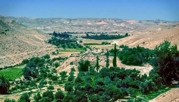
generally accepted site of Kadesh Barnea, courtesy, TouchPointIsrael.com
In Biblical times, the site of Kadesh-Barnea was a major encampment of the Israelites during the Exodus, located at the westernmost edge of the Kingdom of Edom, south of Canaan.
Several times, Kadesh Barnea is mentioned in the Biblical texts: Genesis 14:7 "And they [Canaanite King Chedorlaomer of Elam and his allies] turned back, and came to En-mishpat--the same is Kadesh [Petra?]--and smote all the country of the Amalekites, and also the Amorites, that dwelt in Hazazon-tamar." From Kadesh, Moses sent the Israelites to spy out the Land of Canaan. Only two came back with positive reports. Numbers 13:26 "And they went and came to Moses, and to Aaron, and to all the congregation of the children of Israel, unto the wilderness of Paran, to Kadesh; and brought back word unto them, and unto all the congregation, and showed them the fruit of the land." Numbers 20:1 "And the children of Israel, even the whole congregation, came into the wilderness of Zin in the first month; and the people abode in Kadesh; and Miriam died there, and was buried there." At the site of Meribah which is in Kadesh, Moses disobediently struck the rock that brought forth water (Numbers 20:11). Numbers 20:14-16 "And Moses sent messengers from Kadesh unto the king of Edom…” According to Numbers 34:4, when the time comes that the Israelites will take over Canaan, Kadesh Barnea was designated as being the southwestern most site of the Land of Israel. Deuteronomy 9:23 “And when the Lord sent you from Kadesh-barnea, saying, ‘Go up and take possession of the land that I have given you,’ then you rebelled against the commandment of the Lord your God and did not believe him or obey his voice.” Once the Israelites did take possession of Canaan and divided it among the tribes, Kadesh Barnea was allotted to Judah, becoming its westernmost point (Joshua 15:3).
For centuries, since the beginning of the Roman occupation of Judea, the location of Kadesh Barnea was a source of debate among scholars and later, archaeologists. Recent scholars have maintained a two-site theory, with a western Kadesh in the area of the Sinai Desert, and an eastern Kadesh centered around Petra in, what is today, the southwest of Arab-occupied Jordan. This two-site theory also appears to have been held by Josephus who identified Miriam's burial site (which the Bible identifies as Kadesh) with Petra, and Eusebius of Caesarea an early church father. This was also the opinion of Rabbis Abraham ibn Ezra (12th century) and Moshe ben Nahman (13th century). In 1842, archeologists had concluded that the site actually lies midway between Al-'Arish and Mount Hor in a great treeless limestone plateau. The spring of clear water, which rises at the foot of a limestone cliff, has been called, by the Arabs "Ain-Ḳadis", "spring of Kadesh". By the late nineteenth century, as many as eighteen sites had been proposed. One source of confusion has been the fact that Kadesh is sometimes mentioned in connection with the Desert of Paran (Numbers 13:26) and at other times with the Wilderness of Zin (Numbers 20:1). Nowadays however, a majority tend to agree that the site is the location of a group of springs centered around a place called El Godayrat Spring, in the near vicinity of Ain Kadis, about 46 miles southwest of Beersheba, just over the border from Israel in the Arab-occupied Sinai. And in fact, the Bible does locate Kadesh as south of Canaan, west of the Arabah and east of the Brook of Egypt. According to Deuteronomy 1:2, it is 11 days' march by way of Mount Seir from Horeb. In the aftermath of the Sinai Campaign of 1956, a large fortress from the period of the kings of Judah was discovered Ain Kadis as well as numerous remains strewn throughout the whole area from the Middle Bronze (c. 2000 b.c.e.) and Israelite periods.  
In modern times, Jews began to return to the area. Kadesh was liberated in the Six-Day War in 1967 and in 1980, a Jewish community was established nearby – Nitzanei Sinai. But due to the peace treaty with Egypt, in 1982, Prime Minister Menahem Begin ordered the Israeli army, acting in the form of the SS, to destroy and expel the Jewish inhabitants of the town, as they were ordered to do with the rest of the Sinai Peninsula. In 1986, the whole of Nitzanei Sinai was relocated to the western Negev in an area about midway between Eilat and Rafiah, almost adjacent to the Israel-Sinai border.

Friday, July 17, 2020

JORDAN RIVER AND VALLEY

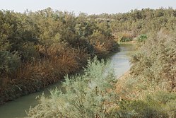
20100923 mer morte13.JPG
Jordan River, courtesy, Wikipedia
The Jordan River and its valley is the principal river valley of Israel but forms the boundary between Israel and the Arab-occupied Kingdom of Jordan. It runs approximately 200 miles north to south from Mount Hermon where the melting snow caps provides its source, through the Sea of Galilee and on to the Dead Sea
According to the Old Testament account, the Hebrew patriarch Jacob crossed the Jordan and its tributary, the Jabbok, in order to reach Haran (Gen. 22:11, 23-24). His descendants, the Israelites, under Joshua, again crossed the Jordan, near Jericho in order to conquer the Promised Land. Later the tribes that chose to settle on the east side of the river, Gad, Reuben, and the half tribe of Menasheh, built a large altar on its banks as "a witness" between them and the other tribes (Josh. 22:10). After the other tribes were allotted its own territories, the Jordan was found to be straddling several in addition to those just mentioned: Menasheh (on both sides), Naphtali, Yissasschar, Benjamin, and Judah. Years later, a part of the tribe of Dan broke off from the main tribal territory, migrated north, and established their own small territory along the northern reaches of the river. (Today, this site is marked by a tel and a kibbutz, Dan.) During the Period of the Judges, Jephtah smote 42000 Ephraimites on the banks of one of the river’s fords (Judges 23:5-6). It seems that these are the same fords mentioned as being near Beth Avarah on the eastern bank, where Gideon lay in wait for the Midianites (Judges 7:24). In the plain of the Jordan, between Succoth and Zarthan, is the clay ground where Solomon had his brass-foundries (I Kings 7:46). The prophets Elijah and Elisha crossed over the Jordan on dry ground, each of whom dividing the waters with a stroke of the mantle (II Kings 2:8, 14). Elisha performed two other miracles at the Jordan: he healed Naaman by having him bathe seven times in its waters, and he made the ax of one of the children of the prophets, float, by throwing a piece of wood into the water (II Kings 5:14, 6:6). The Jordan was crossed by Judas Maccabeus and his brother Jonathan during their war with the Nabatæans (I Macc. 5:24). A little later it was the scene of the battle between Jonathan and Bacchides, in which the latter was defeated (I Macc. 9:42-49). In Christian tradition, the apostle John was baptized at Beth Arava (Matthew 3:56Mark1:5Luke 3:3John1:28). However, Christian pilgrims today tend to go to the site of Qasr al Yahud on the opposite bank as they do to the site of Yardenit, far to the north, below the Sea of Galilee, which is believed to be the place where John baptized Jesus and also where Jesus took refuge when he was pursued by his enemies. The New Testament speaks several times about Jesus crossing the Jordan during his ministry (Matthew 19:1Mark 10:1), and of believers crossing the Jordan to come hear him preach and to be healed of their diseases (Matthew 4:25Mark 3:7–8).
Before the coming of the Arabs, many Jewish farms dotted the Jordan Valley. But due to persecutions by Crusaders and later by Arabs and other Muslims, the Jews moved away. In the 14th century however, geographer Ishtori haParhi settled in Bet Shean where he published his work on his explorations of the Land of Israel, Kaftor Vaferah. Yehoseph Schwarz, a rabbi from Germany who came to reside in Jerusalem in the 19th century, also explored the Land of Israel and spent several weeks studying the Jordan. 
By the early 20th century, a small settlement existed in the Jisr al Majami caravanserai, near the bridge of the same name and south of the Sea of Galilee. According to the 1922 census of Palestine, conducted by the British Mandate authorities, Jisr al Majami had a population of 121 which included only 4 Jews but also 5 Christians and 112 Muslims. The village grew with the establishment of the First Jordan Hydro-Electric Power House nearby by engineer and later politician Pinhas Rutenberg. Further north, in 1934, during the draining of Lake Huleh as part of a Zionist land reclamation project, the old Bnot Yaakov Bridge was replaced by a modern one further south. At the end of the 1936–1939 Arab riots in Palestine, a fortified "tower and stockade" settlement was established adjacent to Jisr al Majami, Kibbutz Gesher. On the "Night of the Bridges" between June 16 and 17, 1946, when the Haganah destroyed several bridges linking Palestine with other countries and used by the British army, the Jisr al Majami Bridge was destroyed. The Syrians captured the bridge on June 11, 1948, during the War of Independence, but later withdrew as a result of the 1949 Armistice Agreements between Israel and Syria when the bridge found itself in the central demilitarized zone that was established.
After the war, the western side of the Valley found itself split in two. The northern half, stretching from Tirat Zvi (est. 1937) north to the Jordan’s headwaters, became part of Israel. The southern half (as well as the eastern bank) which stretched down to the Dead Sea, was under Arab occupation. Jews were banned from the southern half for the next 19 years. During that time, the Israeli portion developed in various ways. Archaeological excavations occurred there between 1950 and 1953 when Philip Guy and Pesach Bar-Adon excavated a 5th-6th century synagogue. The synagogue was incorporated into the Beth Yerah National Park which served as a popular tourist destination during the 1950s and 1960s. In 1953, the Bnot Yaakov Bridge was chosen as the original location for the water intake of Israel's National Water Carrier project, but after US pressure the intake was moved downstream to the Sea of Galilee at Eshed Kinrot, which later became known as the Sapir Pumping Station that began diverting water from the Sea of Galilee to the National Water Carrier. Conflict over the waters of the Jordan River was a contributing factor to the Six-Day War when, starting in 1965, Syria attempted to divert some of its headwaters in collaboration with Lebanon and Jordan, as well as shelling Israeli villages in the valley below from their positions in the Golan Heights. During the Six-Day War, Israel recaptured the Golan and the entire western half of the Jordan Valley and Jews began to return to the Arab-occupied half immediately after. The first town established in the Valley was Mechola in 1967 by Bnei Akiva members and named after the biblical city of Abel-mechola (1 Kings 19:16), which was located in the area. The village of Argaman followed, established in 1968 as a Nahal settlement. It was converted to a civilian moshav in 1971. Its name is an acronym for Arik Regev and Gad Mandel, two Nahal commanders who were killed while pursuing terrorists. Massua was established in 1969 as a Nahal settlement, and converted to a civilian moshav by a HaOved HaTzioni gar'in five years later. Next came Gilgal. Since the founding of Gilgal, 17 other communities sprang up in the Valley, not counting that of Maale Efrayim, which is a separate local council and “capital” of the Valley. Route 90, part of which is named after Knesset member Rehavam Zeevi, connects the town of Metulla in the far north, on the Lebanese border, and traverses the Valley, and reaches as far south as Eilat and beyond, connecting to the Nuweiba-Taba Road in the Sinai which passes through Taba.
(For further information, see postings on the Hashemite Kingdom of Jordan, Degania, DeadSea, Gilgal, Jericho, Jabbok River, and the Huleh Valley.)

Sunday, July 12, 2020

JISH (GUSH HALAV)

Gush Halav Synagogue 0012
ruins of ancient synagogue, Gush Halav/Jish, courtesy, IsraelImage.net
The ancient fortress of Gush Halav is today a small town in the Upper Galilee populated by Phoenician Maronites, Greek Catholics, and Arabs. The residents call it “Jish”. It is where the Tomb of the Prophet Joel is located, for centuries, a Jewish pilgrimage site. The nearest Jewish town is the moshav Kfar Hoshen lying adjacent to the town’s southwest border, founded in 1949 by Jews from Bulgaria.
During the time of Joshua, Gush Halav/Jish was allotted to the tribe of Naphtali. When the Land of Israel was ruled by the Greeks, the town was called “Giscala”. Located in the center of an olive-growing district, the town was famous for its production of large quantities of fine oil as well as fine raw silk. It was also a center of milk and cheese production, owing to the town’s name which means “Milk Bloc”. It is said that two of the leaders of the Sanhedrin, Shemaiah and Avtalyon are buried there and according to Jerome, it was where the apostle Paul's parents lived. It was the native city of the patriot Yohanan ben Levi, better known in history as John of Giscala, an oil merchant who, during the first Roman-Jewish War (66-73 CE), tried to keep his fellow citizens from engaging in battle with the Romans, but when the town was captured and burned by them and the surrounding pagan population, he rose up and, falling upon the assailants with his army, defeated them. He then rebuilt Giscala, making it more beautiful than it had been before, and fortified it with walls. He seems also to have secured the means by seizing and converting into money the grain gathered from Upper Galilee for the emperor. Giscala held out the longest among all the cities of Galilee. Finally Titus attacked it with 1,000 horsemen. But it being the Sabbath, John requested a truce, and secretly escaped in the night with his warriors. The city surrendered the next day, and Titus had the walls razed and the fugitive inhabitants massacred (67 CE). After the destruction of the Second Temple, during the days of the amoraim and tannaim, Gush Halav/Jish remained a largely Jewish town. It was even mentioned in the Mishnah and had strong commercial ties with the Phoenician/Israelite city-state of Tyre. One of the most prominent of the tannaim who live in Gush Halav/Jish was one Eleazar b. Simeon, described in the Talmud as a very large man with tremendous physical strength. He was initially buried in his hometown but later reinterred in Meron, next to his father, Shimon bar Yochai, credited as the originator of kabbalah.
On the summit of the hill on which Gush Halav/Jish stands is a Phoenician Maronite church with the remains of an ancient synagogue beneath it. At its foot, near a spring, are the ruins of a second synagogue, excavated by German archaeologists Heinrich Kohl and Carl Watzinger in 1916, in which an Aramaic inscription was found on a column mentioning a certain Yose ben Tanhum and dated to between 250–551 CE. It was destroyed in the earthquake of 551 but was rebuilt soon after. In a nearby mausoleum, archaeologists also found several skeletons, oil lamps and a glass bottle dating to the fourth century CE as well as several Jewish-Christian amulets.
In 1172, the Jewish traveler Benjamin of Tudela found about 20 Jews living in Gush Halav/Jish. Ishtori Haparchi attended a megilla reading when he visited in 1322. Gush Halav continued to have a strong Jewish community at least until the 15th century.
In October 1948 when the town was taken by the Israeli army, the Muslim Arabs left and the Phoenician Maronite inhabitants of the neighboring Kafr Birʿim came to settle in the village soon afterwards. Since then, the majority village population has been Phoenician Maronites.
In December 2010, a hiking and bicycle path known as the Coexistence Trail was inaugurated, linking Jish with Dalton, a neighboring Jewish village. The 1 ½ mile trail, accessible to people with disabilities, sits half a mile above sea level and has several lookout points, including a view of Dalton Lake, where rainwater is collected and stored for agricultural use.
Today Jish is known for its efforts to revive Aramaic as a living language. In 2011, the Israeli Ministry of Education approved a program to teach the language in Jish elementary schools. Maronites in Jish say that Aramaic is essential to their existence as a people, in the same way that Hebrew and Arabic are for Jews and Arabs.

Monday, July 6, 2020

JEZREEL

TelIzrael006.jpg
ruins of Biblical Jezreel adjacent to the present kibbutz of the same name,
courtesy, Wikipedia
Jezreel today is a kibbutz in northern Israel, established shortly after independence in 1948. It is also an archaeological site located on a low hill on the southeastern edge of the Jezreel Valley. In Biblical times, Jezreel was an ancient Israelite city and fortress allotted to the Tribe of Issachar (Joshua 19:18). Owing to its importance, Jezreel gave its name to the whole district and also played an important role in ancient Jewish history. It was near its fountain that King Saul and his army encamped during their war with the Philistines (I Sam. 29:1). Jezreel was also the hometown of Ahinoam, fourth wife of King David. But it acquired its greatest fame during the reign of Ahab, who chose it for his residence and built for himself a palace (I Kings 18:45). Close to Ahab's palace was the vineyard of Naboth the Jezreelite, so much coveted by Ahab (I Kings 21:1) that it led to his murder in Samaria by royal decree. Following the prophet Elijah's victory over the prophets of Ba'al at Mount Carmel, Elijah instructed Ahab to return home to Jezreel, where he would be reporting on events to Jezebel, his wife, a pagan Phoenician who brought foreign gods into Israel. But "the hand of the Lord was upon Elijah" and he reached Jezreel ahead of Ahab (1 Kings 18:45-46). He then ordered Jezebel’s death. In front of Ahab's palace was an open space where dogs roamed and it was there that they devoured Jezebel's body (II Kings 19:35-37). Jezreel was also the residence of Joram, son of Ahab; there he, along with 69 of his brothers, were murdered at the hands of Jehu. In the 8th century BCE, God mentions Jezreel repeatedly to the Prophet Hosea in connection to the fate of the northern Kingdom of Israel.
Under Roman rule, Greco-Roman immigrants began to arrive in the town, but it remained a largely Jewish town even after the destruction of Jerusalem in 70. In the course of the succeeding Byzantine Christian rule, Jezreel began to be taken over by Christian immigrants causing many Jews to leave. At the beginning of Arab hegemony, Jezreel was left with a tiny Jewish minority. In the 12th century, Rabbi Benjamin of Tudela, a traveler from Spain, found there one Jewish inhabitant, a dyer. The Jewish population fluctuated since then until the last Jew left around the 18th or 19th centuries.
The modern kibbutz Jezreel was founded during Israel’s War of Independence. During the war, the strategically situated Arab village of Zaʿrīn served as a vantage point from which Arab units harassed Jewish settlements in the Harod Valley and tried to block communications with nearby Afulah. A Palmaḥ group took the village in an attack on May 30, 1948. A few weeks later a group of Israel-born youth established the kibbutz on the abandoned site. Today, the kibbutz contains a Monument to the Fallen, a music school Bet HaMusika, Maytronics a robotic pool cleaning company, Neomis Café, and the Emek Chen Potter Studio
In 1987, a bulldozer working near the site accidentally uncovered ancient structures, and a salvage dig was conducted leading to the major dig under the direction of David Ussishkin and John Woodhead over seven seasons (1990-1996). Staff and volunteers from about 25 countries (the largest groups were from United Kingdom, Sweden and Denmark) joined the dig.
Renewed excavations began in the summer of 2012 under the new directorship of Dr. Norma Franklin of the University of Haifa Zinman Institute of Archaeology, and Dr. Jennie Ebeling of the University of Evansville. The excavations uncovered a casemate wall and four projecting towers surrounding the ancient Israelite fortress, built with a combination of well-cut ashlars, boulders and smaller stones, and an upper level of mud-brick, all covering an area of almost 11 acres.

Friday, July 3, 2020

"WEST JERUSALEM"


Many people have asked me when I’ll be writing about Israel’s capital “West Jerusalem”. To which I would write down my usual response here, but I prefer not to use that kind of language on this blog. To read about Israel’s united capital city, I refer the reader here.

JERUSALEM CORRIDOR (PROZDOR YERUSHALAYIM)

landscape, Jerusalem Corridor region, courtesy, Wikipedia
The Jerusalem Corridor is a mountainous geographical district in Israel stretching from Jerusalem on the east to the Shephelah on the west. The largest towns in this area are Beit ShemeshMevasseret ZionAbu GhoshTzur Hadassah and Kiryat Ye'arim (the Biblical Beth Yearim). Today, the Corridor comes under the jurisdiction of the Mateh Yehuda Regional Council.
In Biblical times, this area straddled the border between the Israelite tribal territories of Judah and Dan. Several major Biblical events occurred here. The town of Zorah was the birthplace of the judge Samson who, according to the Biblical narrative, began to be agitated by the Spirit of God in the locality of Mahaneh Dan (the camp of Dan), the district "between Zorah and Eshtaol" (Judges 13:25). After his death in Gaza, Samson's body was brought back for burial in the tomb of his father Manoah between Zorah and Eshtaol (Judges 16:31).
The city of Beit Shemesh was set aside as one of the 13 Kohanic cities for the priests of the tribe of Levi. It is also mentioned in the Book of I Samuel as being the first city encountered by the Ark of the Covenant on its way back from Philistia after having been captured by the Philistines in battle (1 Samuel 6:12-21). Afterwards, it was transferred to the nearby town of Beth Yearim where it remained for about 60 years. In the meantime, David fought Goliath in the Valley of Elah. When he became king of Israel, he transferred the Ark from Beth Yearim to Jerusalem, his capital. In 2 Kings 14, Beit Shemesh is again mentioned as being the site of the battle between King Amaziah of the southern Kingdom of Judah and King Jehoash of the northern Kingdom of Israel. In 701 BCE, Sennacherib, ruler of the Assyrian Empire, destroyed much of Judah resulting in the abandonment of Beit Shemesh, but there seems to have been a later attempt by a group of Judahites at resettling the city, judging by the archaeological discovery of the refurbishing of the water reservoir. In 586 BCE, at the start of the Babylonian Captivity, the inhabitants of Beit Shemesh were exiled. After the Captivity and during the Second Temple period, there was no lasting revival of the city, as opposed to many other places in the vicinity such as Beit GuvrinMaresha, and others.
The Jerusalem Corridor also figures prominently in the New Testament as the location of Beth HaKerem, the birthplace of John the Baptist and the abode of his parents Elizabeth and Zechariah, according to Christian tradition. This town was renamed as Ein Karem under the Arab occupation in the 7th century. Al-Tamimi, the Arab physician (d. 990), mentions an old custom of the Jews of Ein Karem to make wreaths from the boughs (branches) of a wild plant belonging to the mint family (Lamiaceae) during the Jewish holiday of Shavu'ot.[22]
Since the destruction of Jerusalem in 70, there were still many Jewish villages in the Corridor but their numbers eventually and dramatically declined. When the Spanish Jewish traveler Benjamin of Tudela visited the area in c. 1173, he noted a small Jewish community remaining in Beth Guvrin. Jewish pilgrims often traversed the area along the ancient road stretching from Jaffa to Jerusalem. But beginning in the early 16th century, the Abu Ghosh clan from the town of the same name, would often demand a toll from pilgrims regardless of faith. Soon after, the Land of Israel came under the control of the Ottoman Empire but molestation of pilgrims continued. In 1827, Sir Moses Montefiore made his first visit to Israel and travelled on this road. In his diary, he explicitly stated that he was never molested for a toll. In the course of the 19th century, when reforms began to be implemented in the Ottoman Empire, a proper road was constructed on the pilgrimage route (today, the Tel Aviv-Jerusalem Highway (Highway 1)) and a khan was built at Shaar Hagai in 1867 for the accommodation of travelers. It was managed by several Jewish families since its foundation.
In 1854, farmland was purchased from the Arab village of Qalunya (today, Mevaseret Zion) by a Baghdadi Jew, Shaul Yehuda, with the aid of the British consul in Jerusalem James Finn. Thus, the Jewish village of Motza was founded and the first 4 families began to settle there. One established a tile factory which was one of the earliest industries in the region. In 1871, a travelers’ inn was also established. When Theodor Herzl visited Palestine in 1898, he passed through Motza, which then had a population of 200. Captivated by the landscape, he planted a cypress tree on a hill. After he died in 1904 at age 44, it became an annual pilgrimage site by Zionist youth, who planted more trees around Herzl's tree.
In the early 1870s, the Spanish consul in Jerusalem, Alexander Spanoli, bought over 5,000 dunams of land from the Arab villagers of Artuf, which was then sold to the London Society for Promoting Christianity Amongst the Jews. After the pogroms against the Jews in Eastern Europe in 1882, the Society embarked on a fundraising mission, and then used some of the money raised to help Jewish refugees purchase some of its land. Towards the end of 1883, 24 families were settled there, each receiving 150 dunams of farmland, farm animals and tools. But due to economic difficulties and the lack of water, some of the land was leased to Arabs. The Society was still involved in the village’s life though, and the Jewish residents were obliged to attend Sunday meetings and send their children to the missionary school, but there were no instances of outright religious coercion. Most of the residents remained practicing Jews. In 1895, the Bulgarian Hibbat Zion movement bought the 5,000-dunam farm from the London Jews Society and renamed it Har-Tuv (lit. Mountain of Good). Twelve Jewish families settled there and tried to earn a living from agriculture. In 1900, one of the residents inaugurated a carriage service to Jerusalem.
In the following years, other Jewish communities were founded. The village of Kfar Uria was established in 1912 and served as an agricultural training place. Many of the local Arabs were on good terms with the people who lived there and had treated the moshav's association director, Baruch Yakimovsky, as their mukhtar (village chief) as he was on amicable terms with mukhtars in surrounding villages. The farmers of the area, both Jews and Arabs, cooperated and defended each other against raiding nomadic Bedouin. During this time, the leaders of Abu Ghosh decided to work together with the Jews and were also on friendly terms with the Zionist leaders. In 1912, the land on which kibbutz Kiryat Anavim stands, was purchased from the village by Arthur Ruppin, head of the Zionist Organization’s Palestine Office in Jaffa. In 1919 a group of 6 pioneers from the Ukrainian town of Kaminiz Podolsk and Preluki settled there, near a small spring called "Dilb" so-called for the surrounding plane trees. Twenty more arrived there in the spring of 1920 when Zionist leader Chaim Weizmann visited Palestine and was hosted by the residents of Abu Ghosh. Ramat Rahel was established in 1926 by members of the Gdud HaAvoda labor brigade.
In the 1929 Arab riots, most of the Jewish communities in the area, like many nationwide, were attacked and destroyed, often by Arabs from outside the area, resulting in the killing or expelling of the inhabitants. In the early 30s most of the Jewish refugees were able to return home. Hartuv and Ramat Rahel were rebuilt in 1930, as was Kfar Uria whose inhabitants were saved by their Arab neighbors. But in Kfar Uria, settlement was intermittent especially during the resumption of the Arab riots in 1936-1939. It was only settled permanently in 1944 by Jewish stonecutters from Kurdistan. In 1933, Motza Ilit was established near site of the original destroyed community where many had been massacred and the corpses burned.
The kibbutz Maale Hahamisha was founded by members of the Gordonia youth movement on July 19, 1938 as one of 57 strategically-placed tower and stockade settlements founded during the 1936-1939 Arab riots in order to defend the surrounding Jewish communities against Arab attacks. It was named after five men ambushed and killed by Arab gunmen nearby. In 1946, the land on which Neve Ilan is located was purchased by the Jewish National Fund from an effendi  landowner from Abu Ghosh at the urging of David Ben-Gurion in order to establish a "Kibbutz Army Post" to defend the Jerusalem road. The initial 31 settlers were 17 young men and 14 young women, mostly Jewish immigrants from France. Shortly aftereward, six hundred dunams of modern-day Kiryat Ye'arim were purchased by Menashe Elissar, a businessman who was attracted to the site as the location of the biblical Kiryat Ye'arim.
At the end of November 1947, considered the beginning of Israel’s War of Independence, the road to Jerusalem was cut off and the Arabs began to besiege the city’s Jewish neighborhoods. On the other side of the Corridor, the area from Neve Ilan to Hulda, was under their control allowing them to dominate the hilltops overlooking Bab al-Wad all the way to the Neve Ilan plateau. In the meantime, Arabs and Jews fought for control of the Arab fortress settlement of al-Qastal, which overlooked the main Tel Aviv-Jerusalem highway and from where Jewish motorists were routinely ambushed. Al-Qastal exchanged hands several times in the course of the fighting until the Arab commander Abd al-Qadir al-Husayni was killed. Many of the Arabs left their positions to attend al-Husayni's funeral at the Al-Aqsa Mosque on Friday, April 9. That same day, al-Qastal fell to the Yishuv forces, virtually unopposed. Later that month, a battle occurred at Deir Yassin which was especially intense, but Irgun and Palmach fighters liberated that too, at great cost. Unfortunately, many innocent civilians were also killed. News reports in the Arab press described it as a deliberate massacre and the Arab masses believed it without question. It has remained a sore point with them ever since. 
On May 8, Palmach fighters, as part of Operation Macabee, gathered at Neve Ilan in preparation for an attack on the village of Saris, and the western approach to Bab al-Wad. After heavy fighting, that road was finally liberated. Shortly afterward, in order to lift the siege on Jerusalem, the Burma Road was built, under Arab fire. It helped to bring necessary supplies to the Jews in Jerusalem and in October, Israeli troops, in Operation HaHar, finally brought the entire area under their control.
After the War, Ma'ale HaHamisha took in refugees from Gush Etzion, the area of which, had come under Arab occupation. Beginning in 1950, many new Jewish communities were established in the Corridor, many on earlier Biblical Israelite towns. A local re-afforestation project also began spearheaded by the Jewish National Fund. On December 6, 1950, the Hartuv displaced persons camp "Ma'abarat Har-Tuv" was established on the site of the current-day Moshav Naham. Its first inhabitants were Bulgarian Jews. They were soon joined by other Bulgarian Jews as well as those from IranIraqRomaniaMorocco and Kurdistan. In its early years, Beit Shemesh came to typify the "Development Town" with a largely North African population. Maoz Zion ("Stronghold of Zion") was established in 1951 to house new immigrants from IraqKurdistan, North Africa and Iran who had been living in a ma'abara at the foot of al-Qastal. Many were employed at the nearby Solel Boneh stone quarry. Tzur Hadassah was established in 1956 as a regional center for nearby moshavim such as Bar GioraMataMevo Beitar and Nes Harim. It was named for the Hadassah organization. Also in 1956, Neve Ilan was disbanded and vacated, due to economic and social problems but in the late sixties, the Young Judeans in America sent a group to establish an industrial village. The members arrived in early 1970, and moved into the homes built by the Jewish Agency, and the settlement was re-established as a moshav in 1971.
Today, in addition to the Jerusalem – Tel Aviv highway (Highway 1), a number of additional routes lead to Jerusalem; Route 443 which covers the northern part of the corridor; Route 395 leads from Ein Kerem to the coast, via Ramat Raziel and Bet Shemesh, and continues south; Route 386 leads to the Ella Valley, via Bar Giora and Tzur Hadassa. A railway line is also active in the corridor, next to the Sorek Stream, which is part of the historical Jaffa–Jerusalem railway.